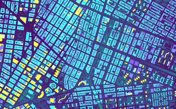
NYC Featured The footprints of every building in NYC The landscape of NYC changes so much that the New York City Office of Technology and Innovation updates a dataset of building footprint shapes weekly.
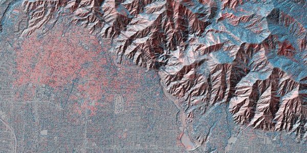
wildfires How LiDAR measures the toll of climate disasters Comparing LiDAR data from before and after the January 2025 fires in Los Angeles reveals the scale of devastation in ways satellite imagery can’t match.
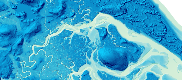
LIDAR Visualizing Rivers and Floodplains with USGS Data Using USGS elevation data to visualize stunning views of the flow of water through rivers and floodplains.
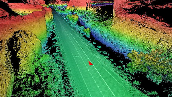
Photologs Utah Highway LiDAR Scans Utah's Department of Transportation uses state-of-the-art 3-D laser scanners to capture the surfaces and area surrounding 15,000 miles of its roads.