
Utah Highway LiDAR Scans
Utah's Department of Transportation uses state-of-the-art 3-D laser scanners to capture the surfaces and area surrounding 15,000 miles of its roads.

In our first post in this series, we looked back to the state-of-the-art in highway photologging technology from 1985, in which vans were tricked out with film cameras and digital readout displays to catalog each mile of roadway each year. Let's fast forward to see what the latest data collection technology looks like in 2022.
Since the early days of photologging, a major leap forward has occurred in the volume and types of infrastructure data collected by state governments, aided by advances in imaging technology.
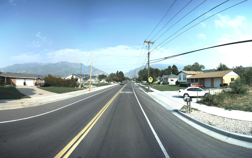
High resolution cameras collect panoramas of the roadways, downward-facing lasers scan every crack and divot of the surface of the pavement, and all of the timestamped data is precisely tagged with geolocation information in searchable databases.
But in addition to all these impressive advances, the state with highways that run through some of the most beautiful natural scenery in America has gone a step further. Utah's Department of Transportation uses state-of-the-art 3-D laser scanners to capture the surfaces and area surrounding 15,000 miles of its roads.
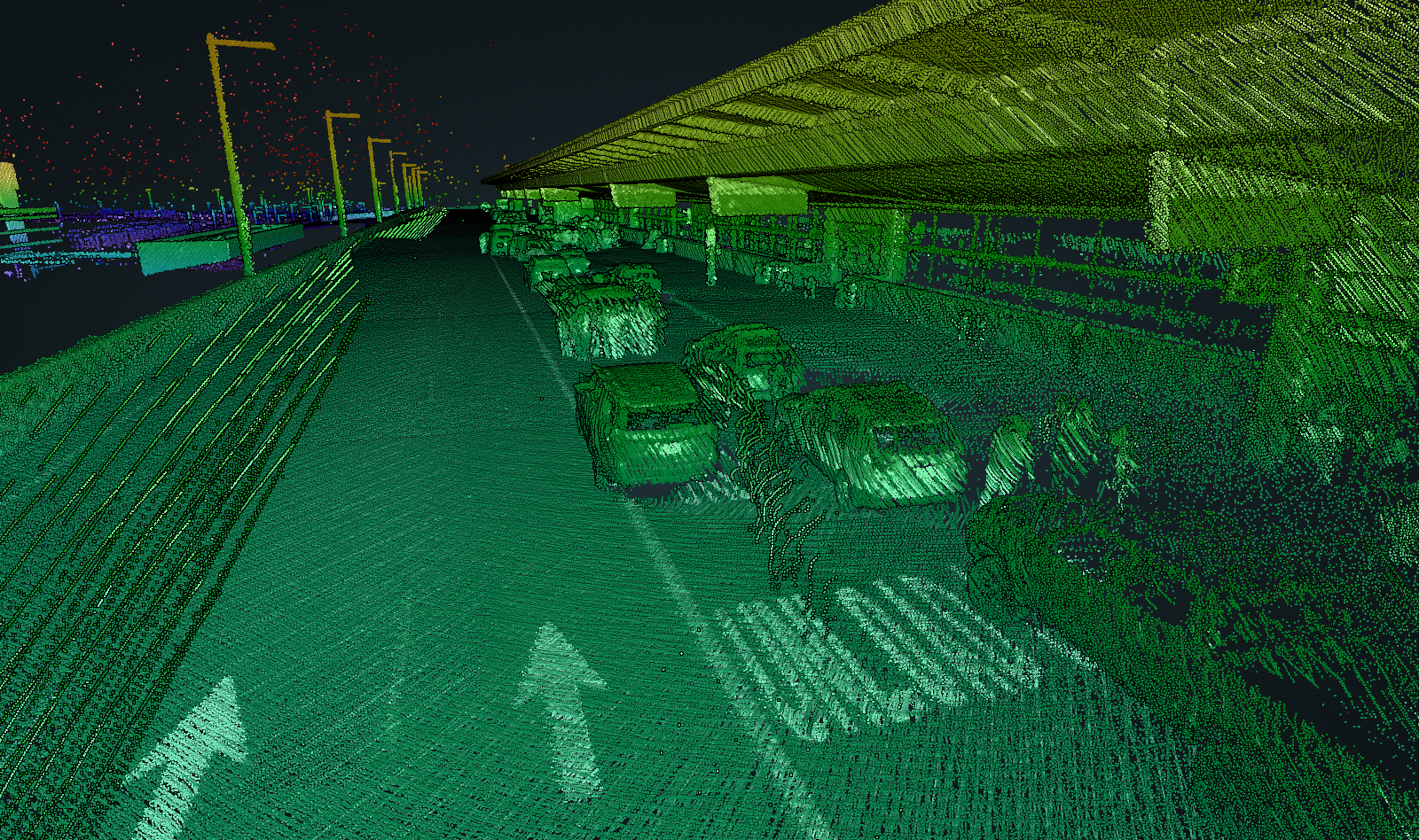
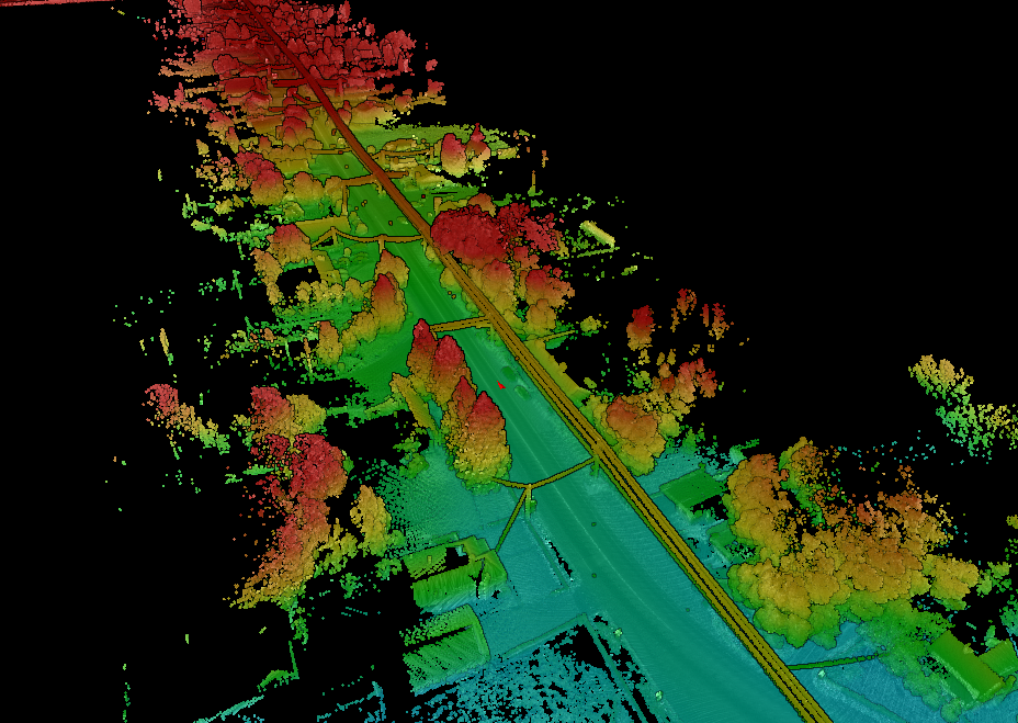
The vehicles cataloguing Utah's highways utilize a pair of 360 degree LiDAR (Light Detection and Ranging) sensors mounted on top of the vehicle, each road surface, sign, tree, bush, power line, rocky cliffs, fences and houses are all coated with over a million points of infrared laser light per second which is processed by the sensor to create a detailed 3-D model of the area surrounding the highway.
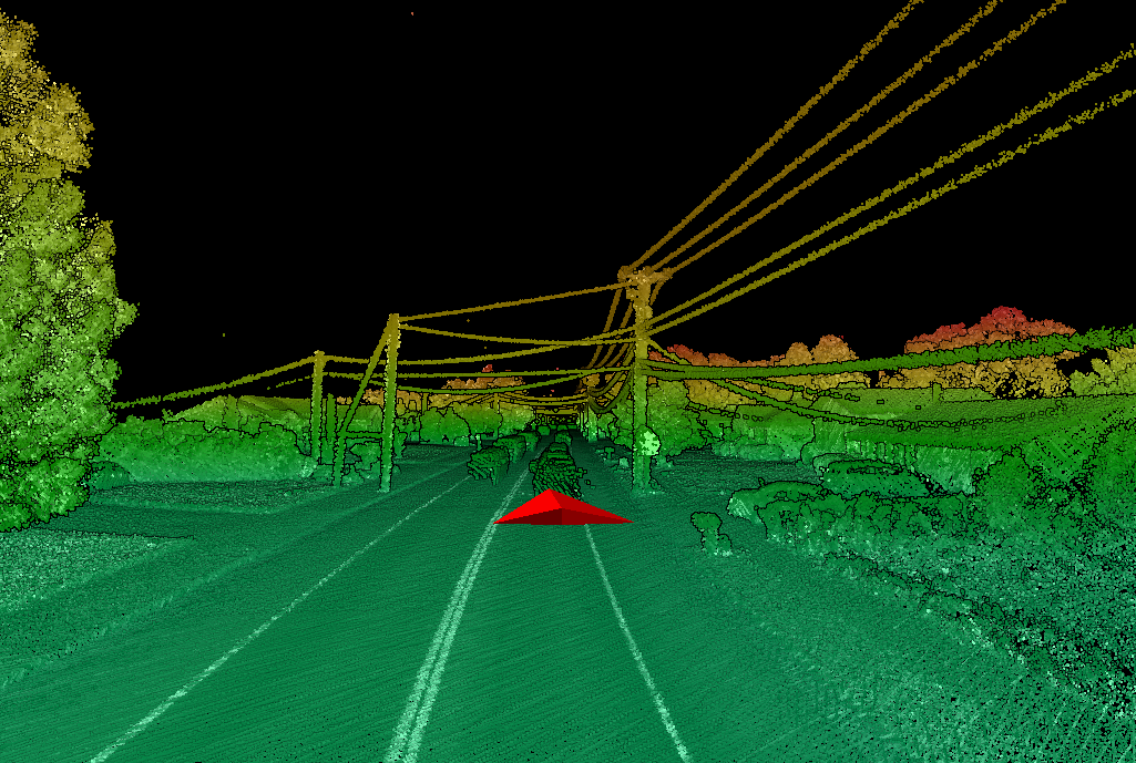
All of this point cloud data (which can be huge) can be viewed in a modern web browser, which lets users fly around and change the angle of view as the virtual vehicle moves through a point of dots like an explorer revealing the stone walls of a dungeon via lamplight.
For over 20 years, federal, state and local governments have been utilizing aerial LiDAR scans (both space-based and aircraft-based) to get an accurate record of the surface of the earth and the human infrastructure we have built on top of it. Some of the uses of large-scale LiDAR scanning include precise measurements of seismic fault lines to measure subtle movements, monitoring erosion and volcanic activity.
The USGS’ 3D Elevation Program hopes to have “the first-ever national baseline of consistent high-resolution three-dimensional (3D) data—including bare earth elevations and 3D point clouds” completed by 2023.
In July of 2017, Utah's Department of Transportation signed a $6.8 million contract with Wisconsin-based Mandli Communications. Inc. to undertake a large-scale "roadway features" data collection effort, calling for the collection of roadway images, road surface scans and LiDAR scans of the road surroundings. The company had been working with Utah since 2012 on its photologging program. In July of 2021, the contract was amended for an additional $900,000 to continue the data collection through 2023.
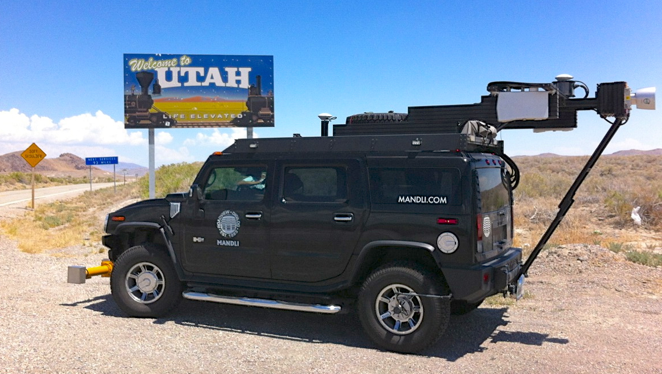
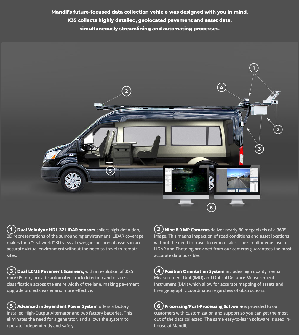
Mandli's website advertises its "X35" data collection vehicle which is equipped with nine 8.9 megapixel cameras, dual Velodyne HDL-32 LiDAR sensors, dual Laser Crack Measurement System pavement scanners and a position orientation system with battery back-up power.
I have been looking at dozens of states’ current photologging efforts recently, and Utah’s photologging site appears to be one of the most robust, with excellent tools for the public to access and explore this visually rich data. Utah is not the only state to being using LiDAR scans to enhance its roadway data collection, and Mandli has other state and local governments as clients using the same solutions.
LiDAR is not the only way to gather detailed geometry of the world around us. Photogrammetry is a software-based process for extracting detailed 3-D geometry from a series of 2-D images. Cheap, powerful computing power and a continued improvement in digital camera technology have made photogrammetry a potential alternative option for data collection efforts, with the potential for cost savings.
Recently researchers compared Mandli’s LiDAR based data collection quality against a photogrammetry based approach that University of Utah researchers assembled from consumer-level electronics. The researchers found their approach compared favorably to Mandli’s data in terms of easy of use and quality, with slightly less consistency and accuracy but significant cost savings.
These datasets are recording rich snapshots of the land around us that will only become more valuable over time. As natural and man-made forces change our landscape, we now have a geometric record of the world around us that can be compared to after changes occur to measure and quantify the altered geometry.
As these LiDAR scanning efforts become more widespread (and increase in quality), the current record of how Earth was in our age will get filled in, adding to our record of photography, film and sound.
For this post, I was excited to download the raw LiDAR point cloud data, which thankfully Mandli's "Road View" web app lets you do (as
.LAS files). I did import some of this data into a few different 3D apps, but found that the data didn't always come through the way I had expected. I was trying to convert them into a mesh using the fantastic open source Cloud Compare (which I have done before) and I also attempted a few other apps, but didn't like the results, and I was going too deep down the rabbit hole 🐇.One of the nicest things about this point cloud viewer is the use of
potree which is an open-source WebGL point cloud renderer. I want to play around with this some more. To capture the 20 minute video of the point cloud, I just ran a simple javascript loop with an interval in the console to click the "step forward" button on the viewer every five seconds (as it takes a bit for the scene to populate). The I just had a similar loop running Apple's command line
screencapture utility in the terminal, to capture my second monitor screen. Not elegant, but sometimes you need to just get things working.🤷🏻♂️
You can subscribe to our newsletter to get future posts delivered to your inbox for free. 👉🏻 📫 Subscribe now.
Sharing is caring
📣 If you think your followers or friends may like it, please consider sharing it.
🙋🏻♀️ If you have any suggestions, comments or requests, please email them to beautifulpublicdata@gmail.com
Thanks for reading!
- Jon Keegan (@jonkeegan)