
Highway Photologs
Highway departments all around the country had "photolog" programs, some dating back as early as 1961. Each year, specially tricked out vans would drive each mile of state road snapping photos to document the status of roadways.

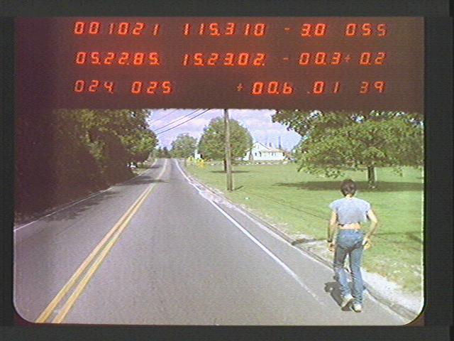
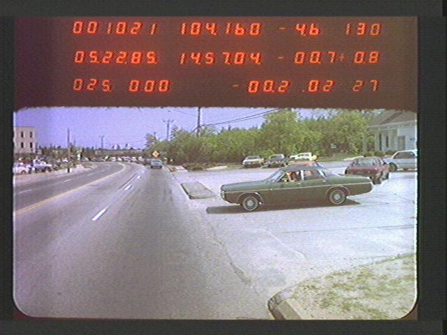
What you are looking at is a timelapse of 6,137 images that were captured on May 10, 1985 by a special van driving south on Route 1 through Connecticut. This vehicle was a “Photolog” van, owned and operated by the Connecticut Department of Transportation. In 1985, this van was tricked out with a front-facing camera, and this cool data readout panel with seven segment displays ticking off the mileage and bearing, taking a picture out the front every 0.01 miles (52.8 feet).
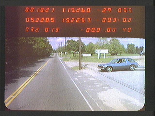
May 22, 1985 driving north on Route 1 in Connecticut. An AMC Pacer on the right! My family had one of these.
Highway departments all around the country had highway photolog programs, some dating back as early as 1961. Every other year this van would drive over 7,000 miles of highway in Connecticut, snapping millions of such photos all along the way.
I obtained 120 gigabytes worth of this imagery and data from the Connecticut Department of Highways via a public records request.
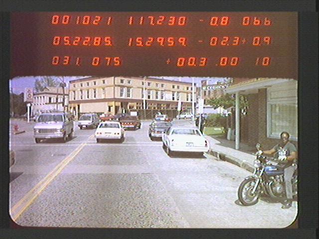
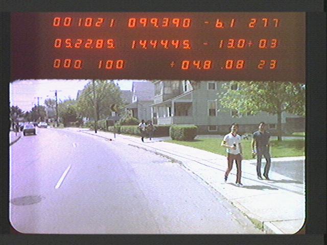
Why did these programs exist? States simply needed to know what each bit of road looked like. What was the condition of the traffic signs, exit ramps, roadway paint and what did the surface of the road look like? But they also captured some beautiful scenes, old stores that no longer exist, hilariously low gas prices and some beautiful old cars on the road, and often people just walking by the side of the road.
Over the years, such data collection runs added side and rear cameras, and have been modernized with 3-D scans of the geometry of the road surface, and higher resolution cameras. Today, many states have retired these cool data collection vans, as the work has been outsourced to third parties, and Google maps and other mapping providers make such efforts seem antiquated.
But many states’ highway departments have shelves full of this old footage (a lot of it on 35mm film, and later, laser discs), going back decades. I think this is a great example of beautiful public data.
My name is Jon Keegan (@jonkeegan), and I’m a data journalist and I’m going to be posting my favorite examples I’ve found of visual data sets that our governments (local, state and federal) collect – ones that I think are kind of beautiful. I’ll try to explain how and why it was collected, and I'll present the visuals in interesting ways.
If you know of any other cool visual information that your government collects, let me know and I’ll try to get a hold of it via public records requests where possible (like I did for this data set).
If you found this niche content interesting and want to see more of this sort of thing, please subscribe to my free newsletter to be updated when I post about a new dataset.
Thanks for reading! 🚐 📸 🛣
This data was all provided to me in a proprietary database format (.CJL files – concatenated JPEG library), which required the use of a PC app called TofuBB to export the images. I received a file for each year, route and direction that I requested (for example: 1999, Route 66, Eastbound). I exported them then turned them into a video using ffmpeg.
You can see some of the full sequences of images on our YouTube channel.
I'd like to extend a big thank you to Robert Kasica from Connecticut's Department of Transportation for help with this records request. 🙏🏻
You can subscribe to our newsletter to get future posts delivered to your inbox for free. 👉🏻 📫 Subscribe now.
Sharing is caring
📣 If you think your followers or friends may like it, please consider sharing it.
🙋🏻♀️ If you have any suggestions, comments or requests, please email them to beautifulpublicdata@gmail.com
Thanks for reading!
- Jon Keegan (@jonkeegan)