
The Beautiful Public Data 2026 Holiday Catalog
The Beautiful Public Data 2026 holiday catalog, featuring four new items. Every item in our shop has a story behind it.

Hello dear readers! We are racing towards the end of an eventful year, and I know you still need to find some unique gifts for the people in your life, and you only have a few weeks left.
The only thing I love more that writing about these crazy datasets in this newsletter, is turning them into niche merch. I've got a nice batch of new items for the 2026 holiday shopping season.
I made a choice a few years ago to keep the newsletter free, rather than ask for subscription fees. Instead, I decided I would sell merch to my nerdy readers — featuring the datasets I write about.
So if you would like to support this project, please consider buying some of this fine merchandise for the holidays. 🙏🏻
And before you scroll down, rest assured — I did not make any merch featuring the last edition's Visible Human dataset. 💀
To my loyal readers, you can use code 15HOLIDAY26 for 15% off any order of $60 or more through December 31, 2026 (excluding gift cards). Shipping is free for all items in the US, and US orders placed by December 9 will arrive by Christmas.
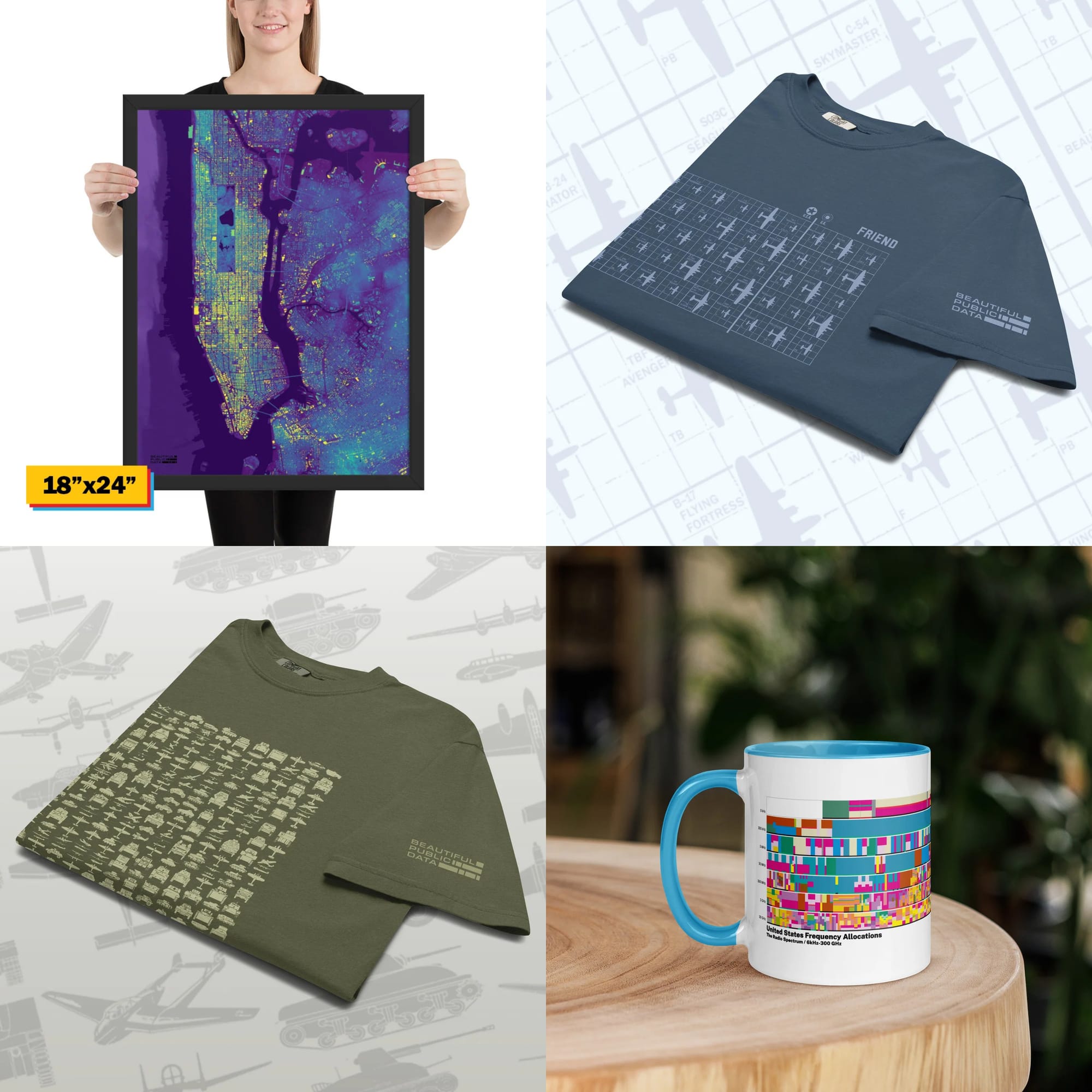
US Frequency Allocation Chart Coffee Mug
I just renewed my technician class ham radio license, and every day I look at a poster of this crazy, beautiful chart which is hanging on my wall in my office.
If you know any amateur radio operators (aka hams) or other radio nerds, they will instantly know what this chart is. Every band from 6 kHz to 300 GHz is mapped and color-coded by how it’s used, including AM and FM radio, TV broadcasting, cell phones, Wi-Fi, GPS, aviation, maritime, satellites and radio astronomy.
So I wrapped it around a colorful mug. Turn the mug around and you’ll find a color legend for every allocation type, so you can decode the airwaves over your morning coffee.

US Frequency Allocation Chart Coffee Mug
The NTIA's beautiful radio frequency allocation chart wrapped around a colorful coffee mug.
$29 with free shipping in the US.
Every Building in Manhattan: NYC Building Footprints & Elevation Framed Print
After writing about the New York City Office of Technology and Innovation's building footprint dataset, I couldn't help myself – I had to dive back into QGIS and make a print out of this insanely detailed visualization. This comes in two sizes: 18"x24" and a jumbo 24"x36". This is a unique conversation piece, and like all of the other things in this shop, there's a story behind it.
The details in this map deserves a big canvas.
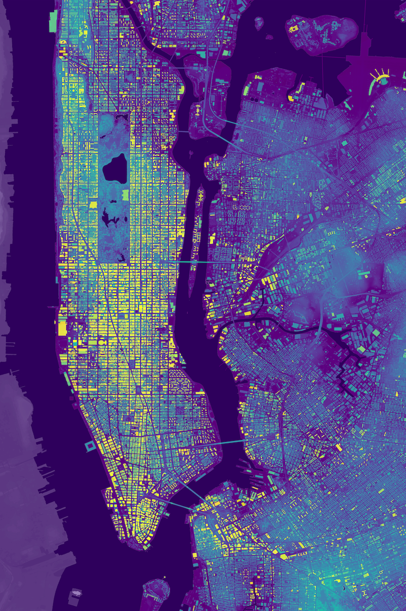


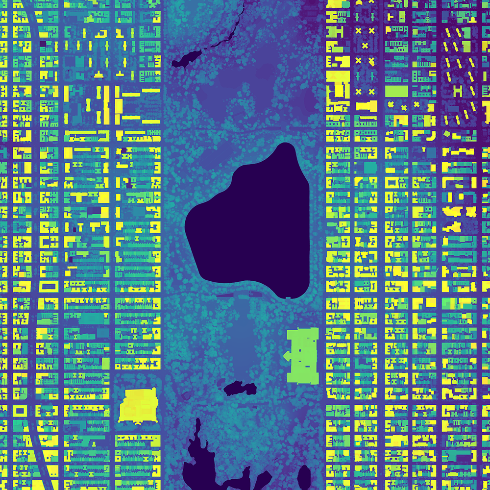
Details from the NYC building footprint print
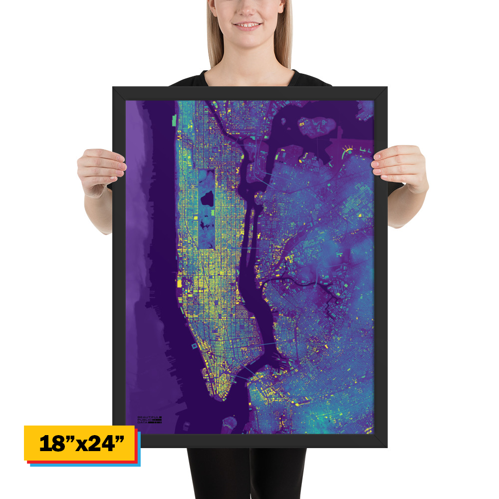
Every Building in Manhattan framed print
The footprint of every building on the island, from New York City’s own building dataset, layered over elevation data.
Framed, 18" × 24" or 24" × 36". Starting at $148
WWII Vehicle Recognition Tees
During World War II, spotters, gunners and pilots had to tell friend from foe in seconds, from a speck on the horizon. The military’s solution was a series of easy-to-read recognition charts: clean silhouettes of every aircraft and armored vehicle, drawn to be memorized.
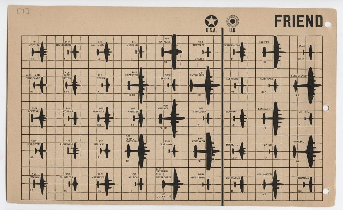
I absolutely love the design of these field manuals, which employ clear, easy to read silhouettes. I recreated this "FRIEND" page from the 1943 War Department FM 30-30 manual, which lays out the shapes of some of the most iconic military aircraft from World War II. I knew I had to get these onto a shirt.
A great gift for WWII history buffs.
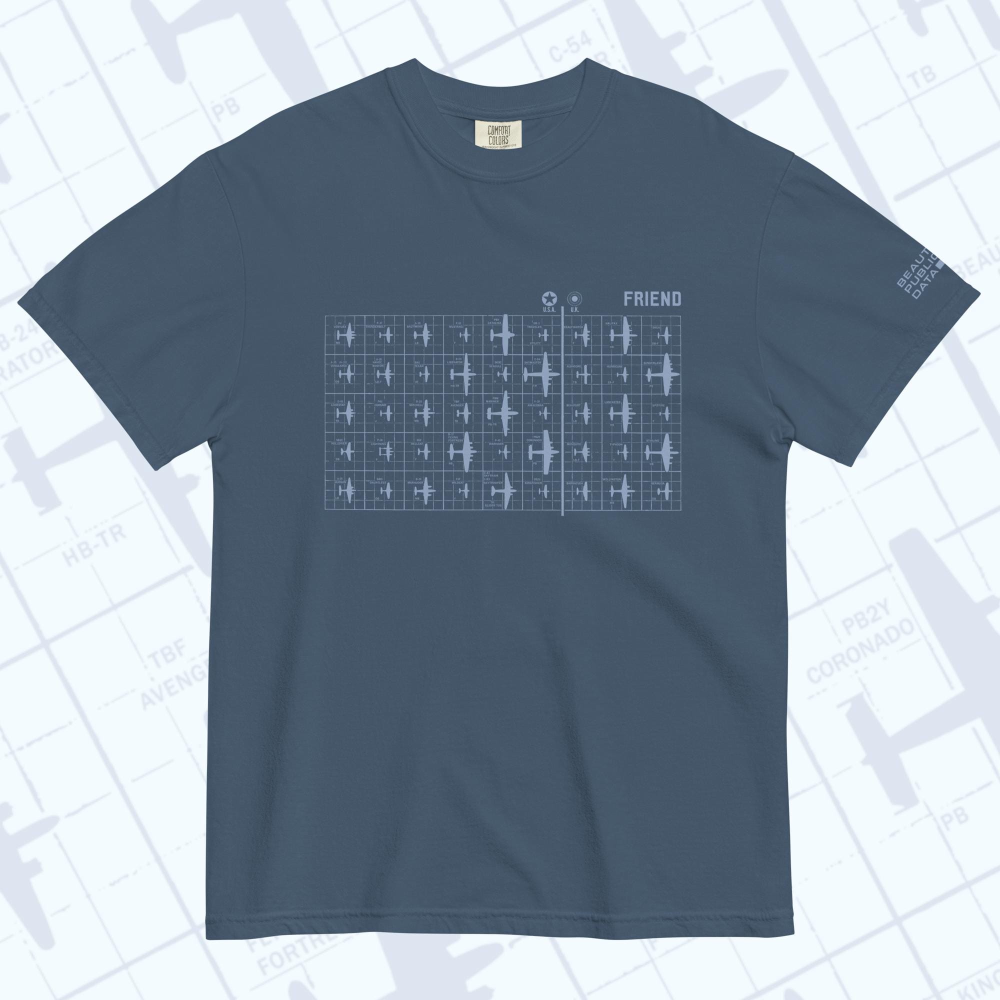
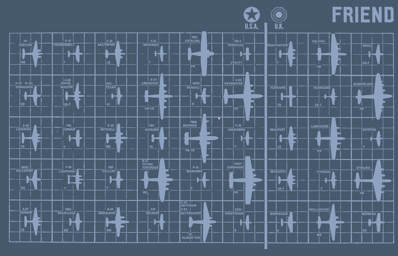
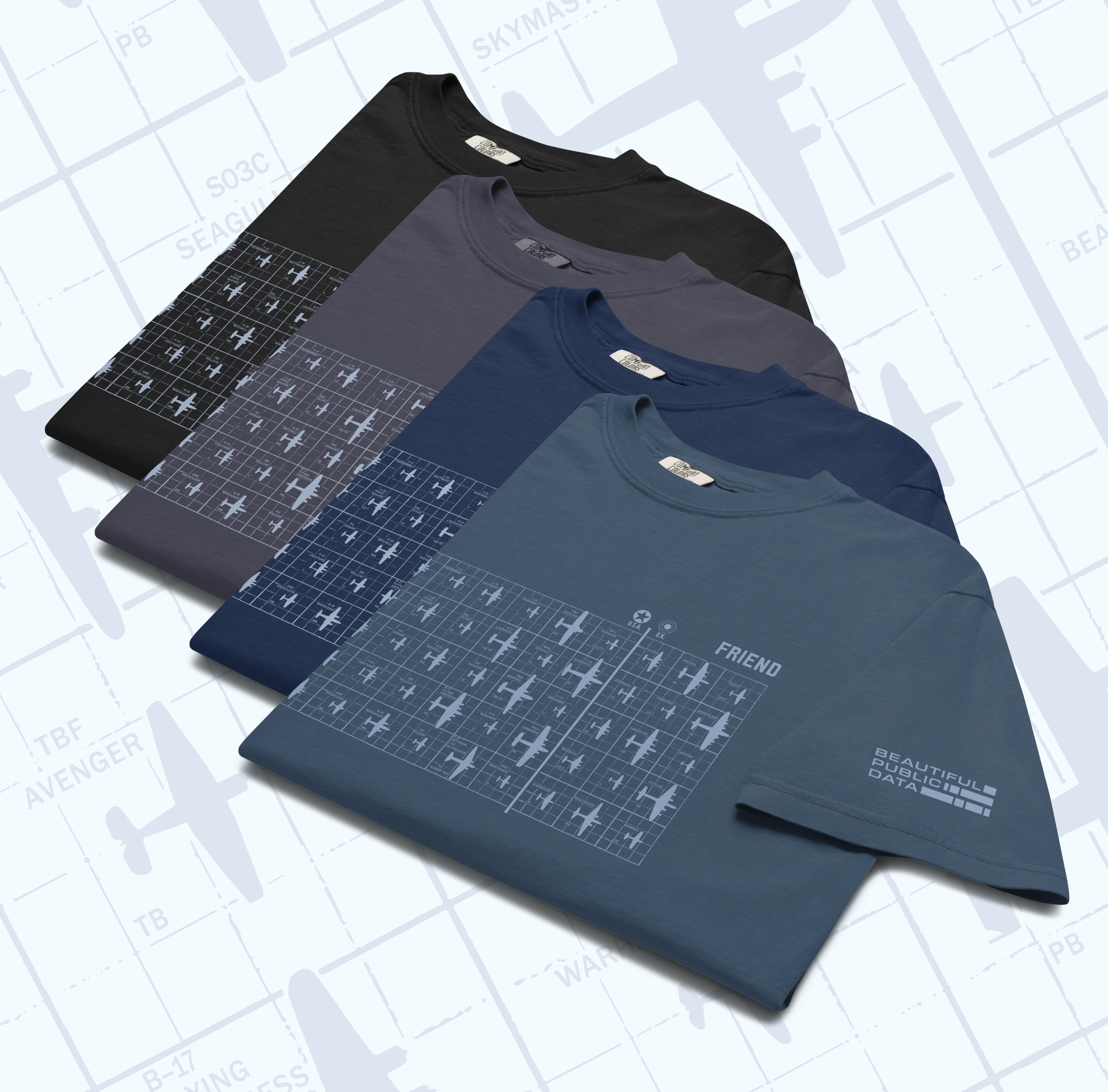
Friend or Foe: WWII Aircraft Recognition Tee
From a page in a 1943 World War II War Department field manual. U.S. and British aircraft in a grid, printed in pale blue on dark colors.
$36 - $38 with free shipping in the US.
The 1943 "FM 30-40 Recognition Pictorial Manual on Armored Vehicles" is full of pages of crisp black silhouettes of Allied and Axis tanks and armored vehicles rendered at a consistent scale: viewed from 5 yards away, a silhouette represents the vehicle as it would appear at 400 yards.
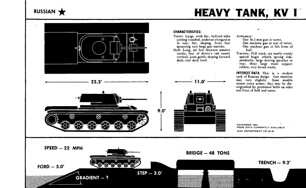
I went through and collected all these sharp illustrations (along with some of the plane silhouettes from the 30-30 manual) to make this quilt of WWII military machines.


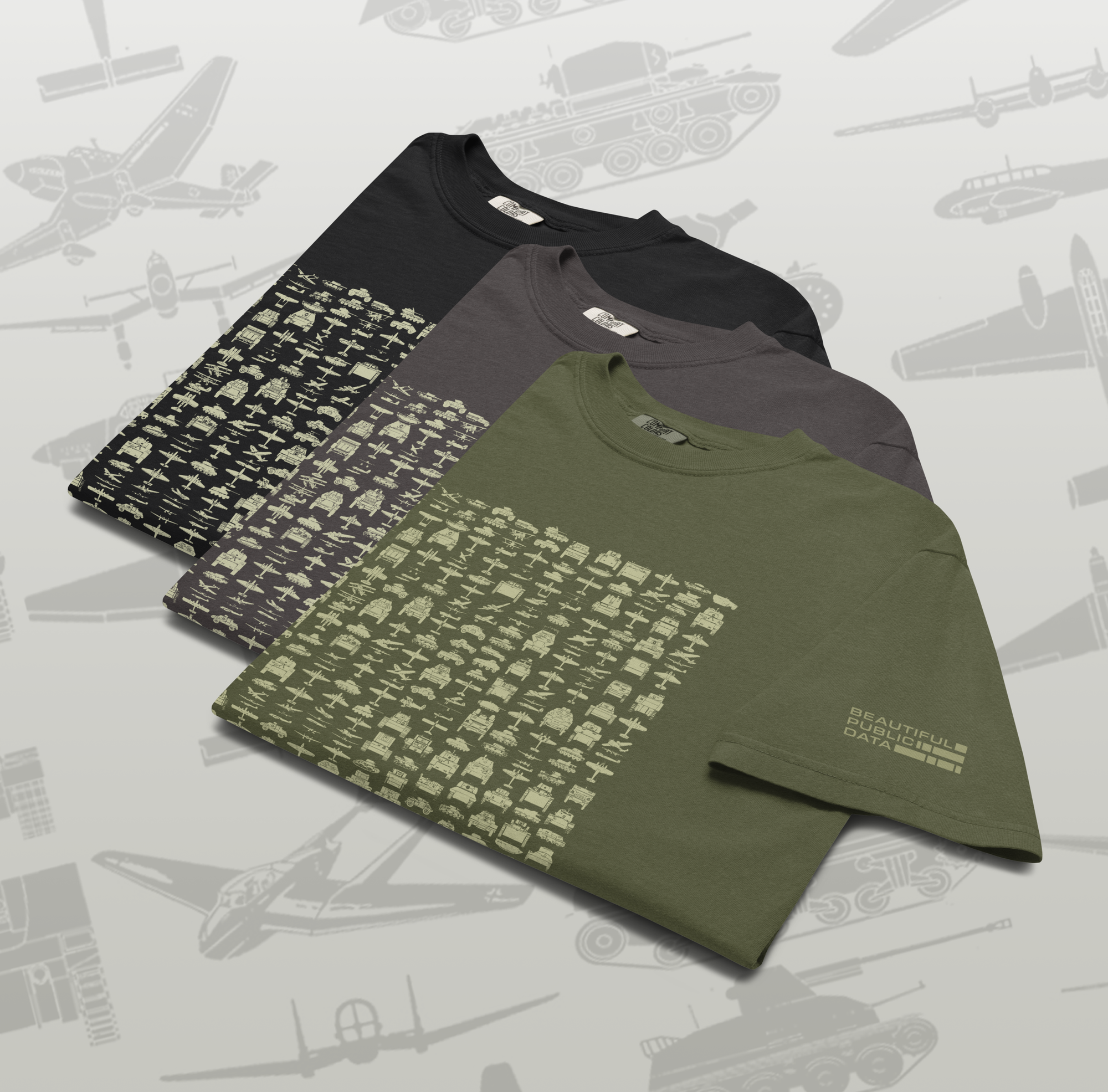
WWII Vehicle Recognition Tee
Hundreds of World War II tanks, half-tracks and planes from a War Department field manual. Printed in pale sage on dark colors.
$36 - $38 with free shipping in the US.
Beautiful Public Data Gift Card
Not sure what to pick? A Beautiful Public Data digital gift card arrives by email in minutes and works for anything in the shop.

Beautiful Public Data Gift Card
Can’t decide which item they’d love most? Let them choose. Delivered by email in minutes and good for anything in the shop.
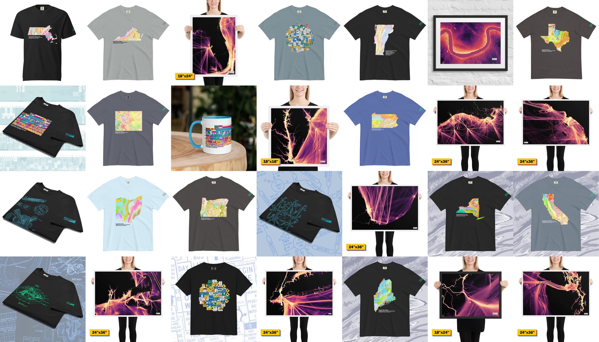
And if you haven't checked out the shop in a while, we have 45 different products that you might have missed.
USGS State Geology Tees
Decades of state and federal geologic surveys, synthesized by the USGS into the most detailed map of the nation's bedrock ever assembled. Each shirt here is a single state lifted straight from that map — its basins, batholiths, and coalfields rendered exactly as geologists mapped them. The ground you stand on, as something you can wear.
I got a little obsessed with these, so there's a whole collection to browse. These are really beautiful, unique maps.
We have light and dark options for Massachusetts, New York, Vermont, Maine, California, Colorado, Oregon, Virginia, Ohio, Pennsylvania, and Texas. That's more than 40% of the US population that is represented in our shirt collection!
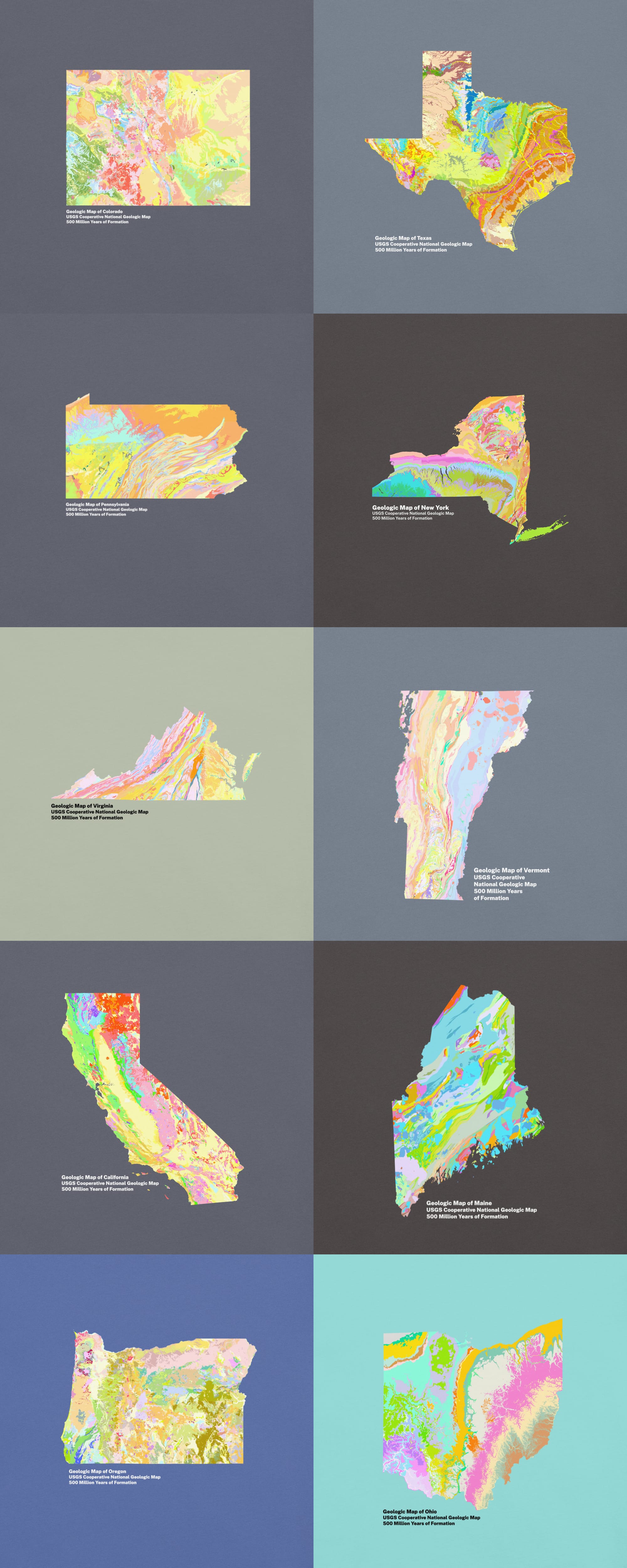
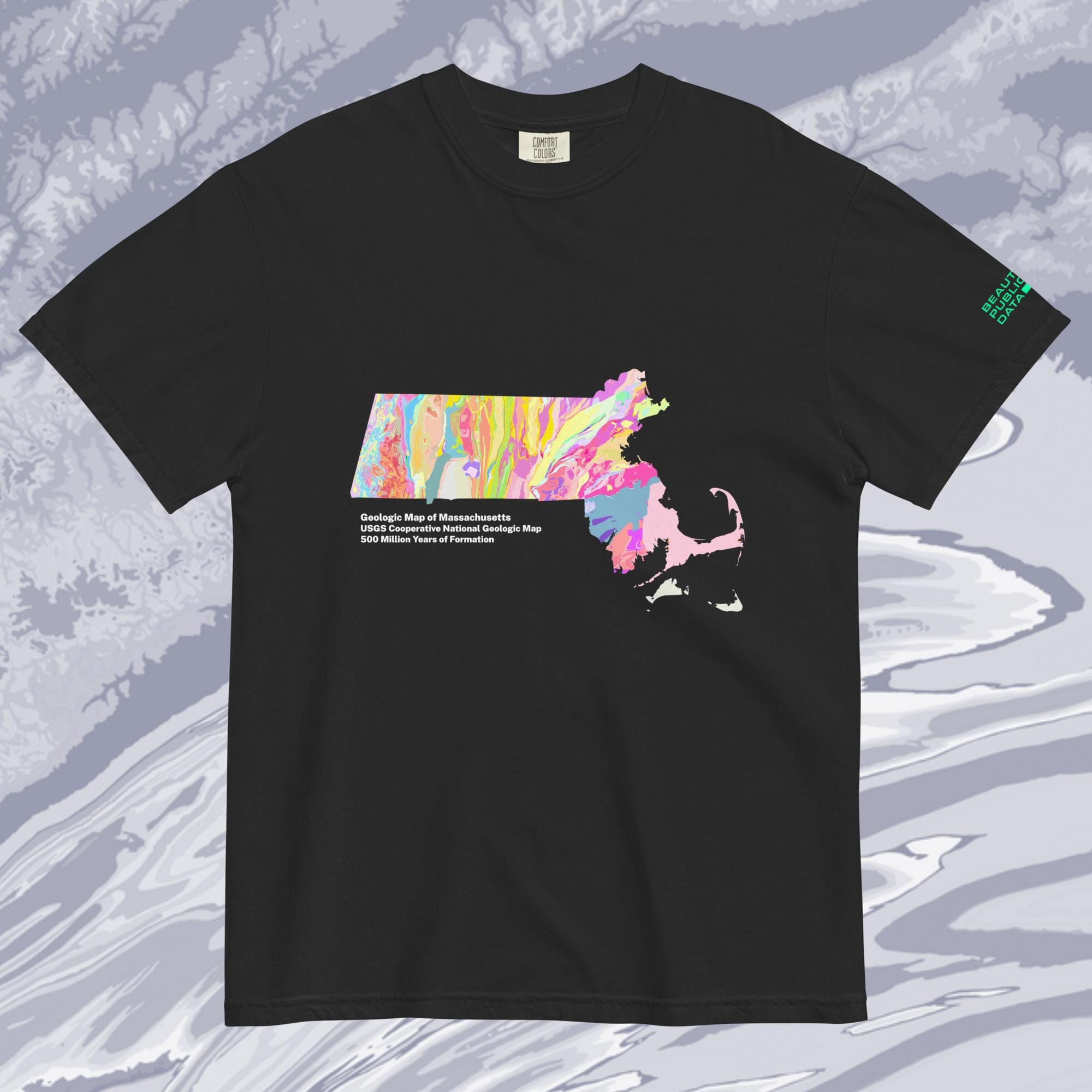
USGS State Geology Tees
So gneiss.
A new, colorful map from the USGS synthesizes decades of state and federal geologic surveys to create the most detailed visualization of the geology of the contiguous United States to date.
$36 - $38 with free shipping in the US.
AIS Ship Traffic Maps
I really love working with AIS ship movement data. These visualizations of a year's worth of ship traffic around the US using NOAA data are some of the favorite things I have made while working on this project. We've got all the major ports in the US.
Featuring prints of Cape Cod MA, Florida, New York City, Seattle / Tacoma / San Juan Islands, Southern California, Hilton Head SC, DelMarVa, the Gulf of Mexico, Chicago / Lake Michigan.
You can browse the collection here.

AIS Ship Traffic Maps
Ships at sea are constantly broadcasting their real-time location, identification, speed, and orientation data via AIS. Plotting out a years worth of ship movements (2023) reveals beautiful patterns of our journeys at sea. Ferries, fishing boats, cargo ships and sailboats' coordinates etch electric pathways in these stunning visualizations of NOAA data.
Starting at $108 framed with free shipping in the US.
Thank you for reading this year, and I am looking forward to sharing more stories with you in 2027!