USGS The USGS Cooperative National Geologic Map A new, colorful map from the USGS synthesizes decades of state and federal geologic surveys to create the most detailed visualization of the geology of the contiguous United States to date.
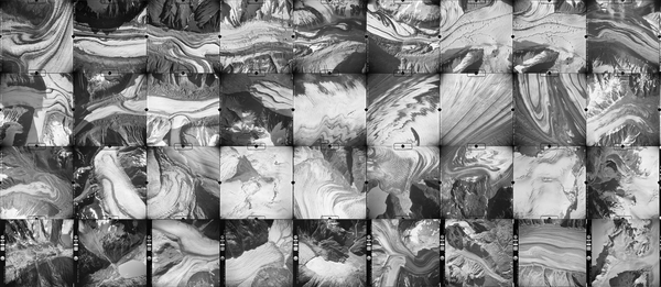
USGS Featured Aerial Glacier Photographs A collection of 100,000 striking high-resolution aerial photos of glaciers, photographed over 40 years with a 63-pound WW II surveillance camera.
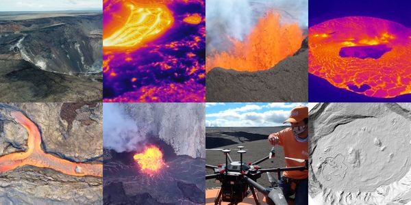
USGS Mapping Volcano Eruptions With Drones Drones have become an essential tool to map, measure and observe the extremely dangerous environments surrounding volcanic eruptions.
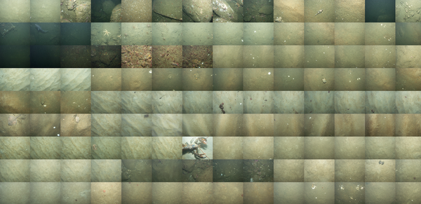
USGS Mapping the Sea Floor USGS research vessels equipped with cameras, sonar and scanners created a map of 125 square miles of the sea floor off Cape Ann, MA.