
Mapping the Sea Floor
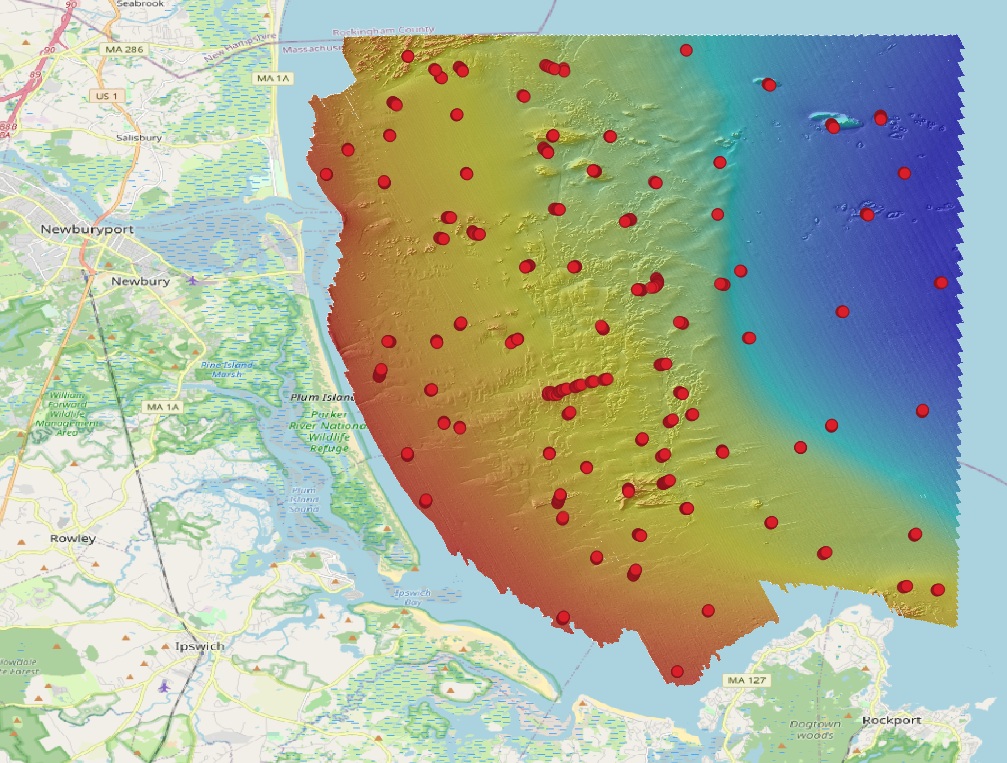
USGS research vessels equipped with cameras, sonar and scanners created a map of 125 square miles of the sea floor off Cape Ann, MA.

USGS research vessels equipped with cameras, sonar and scanners created a detailed map of 125 square miles of the sea floor off the coast of Massachusetts.
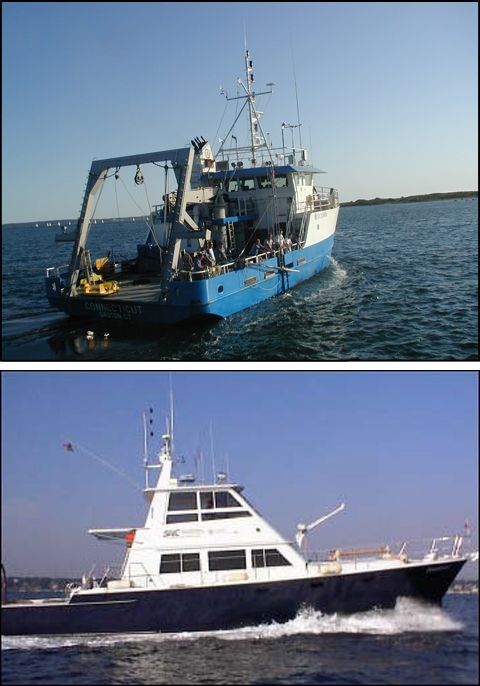
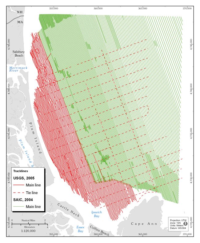
In 2004 and 2005, two research vessels, Ocean Explorer and Connecticut set off into the waters off Cape Ann, Massachusetts on a U.S. Geological Survey mission to map a section of the bottom of the sea. Equipped with cameras, advanced sonar and bathymetric scanners, these ships mapped 125 square miles of the sea floor capturing a detailed dataset that allowed U.S. Geological Survey scientists to characterize the makeup of the sediment and bedrock in waters up to 92 meters deep.
While this research project was just one of many such efforts to map the sea floor, it serves as a good example of what such data collection projects look like.
Following a series of predetermined survey lines, the vessels cruised along at 5 knots and collected detailed bathymetry data (the actual shape and structure of the sea floor) from side-scan sonar and multi-beam echo sounders to create a "high resolution chirp seismic reflection profile" of the material beneath the seafloor, revealing the contours of sediment and bedrock.
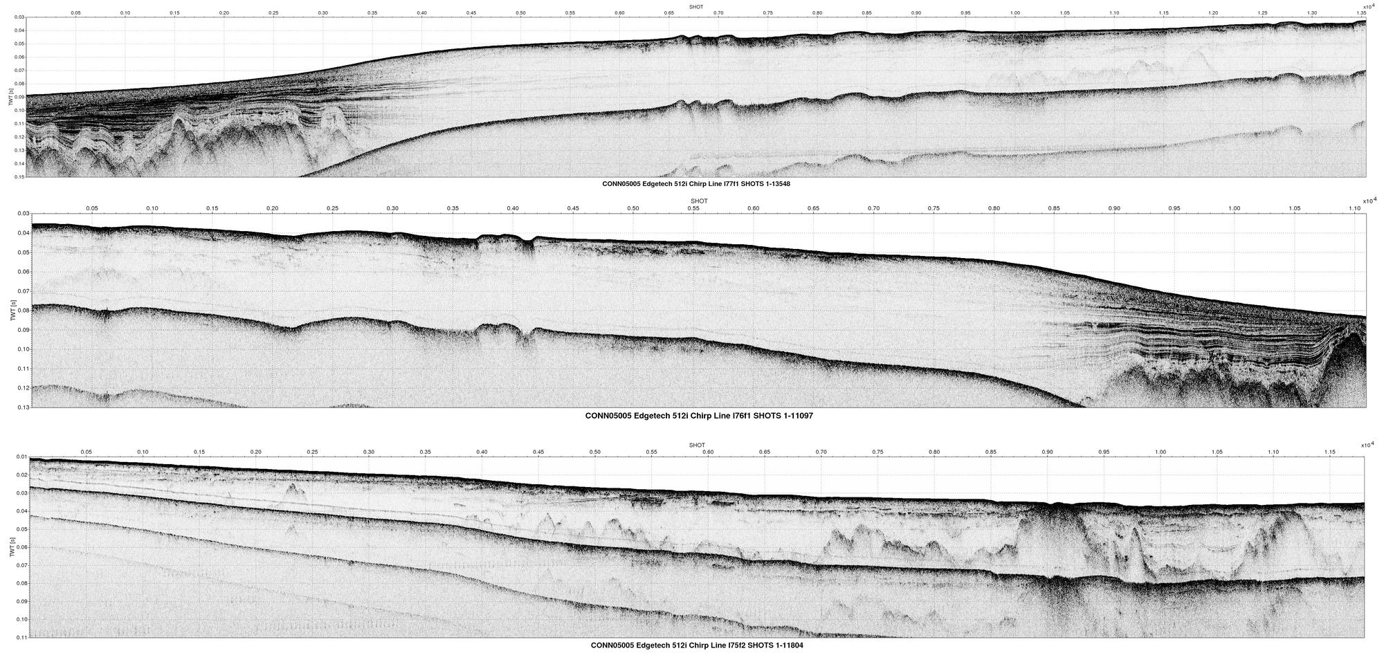
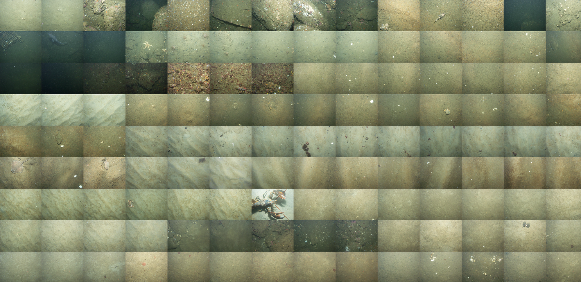
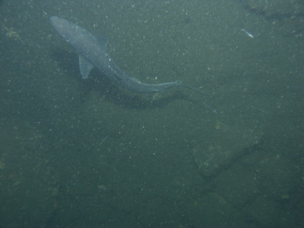
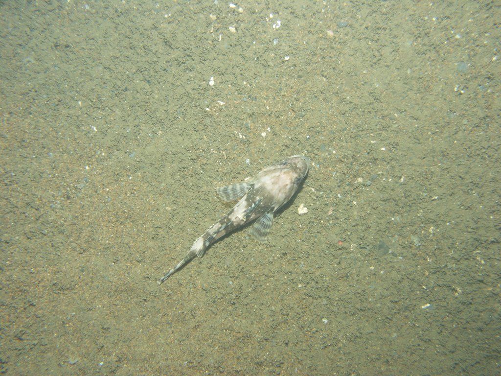
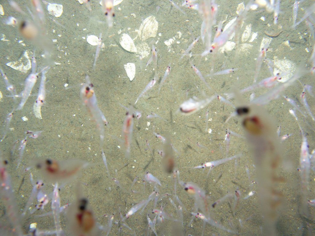
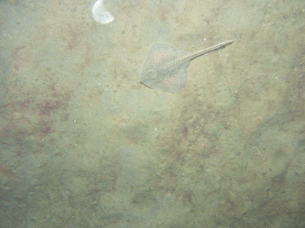
In addition to these advanced acoustic data collection tools, “ground validation” samples of sediments were collected at 87 locations, accompanied by a series of sea floor photographs and video sequences. Using the USGS’s SEAbed Observation and Sampling System (SEABOSS), 834 photographs were taken as the SEABOSS unit drifted between 1 and 3 knots about a foot and a half above the sea floor.
In addition to an array of cameras and sensors, the instrument has a metal scoop that can be used to grab a sample of sand from the ocean floor for inspection upon ascent.
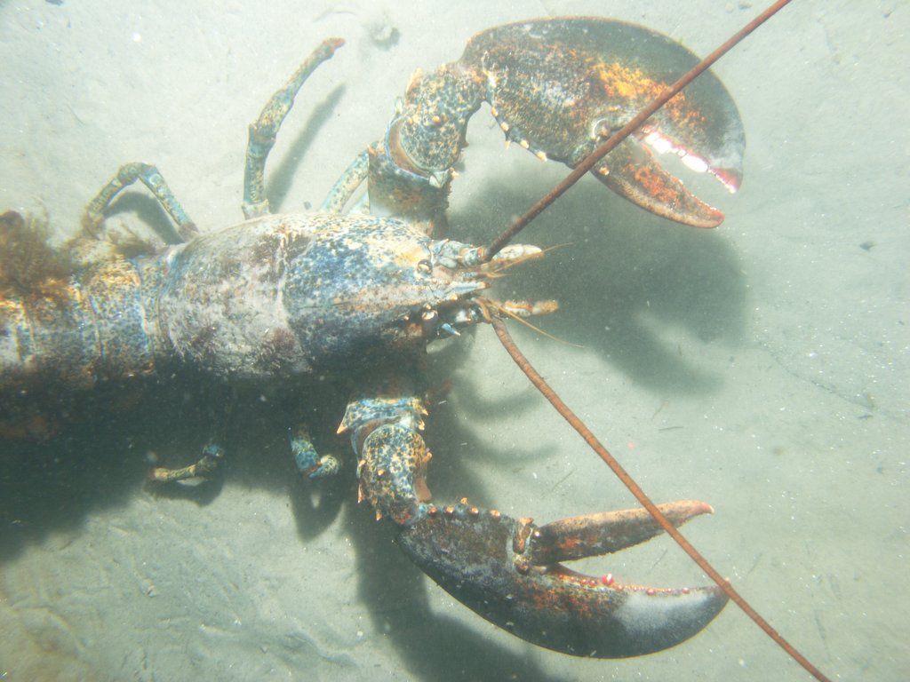
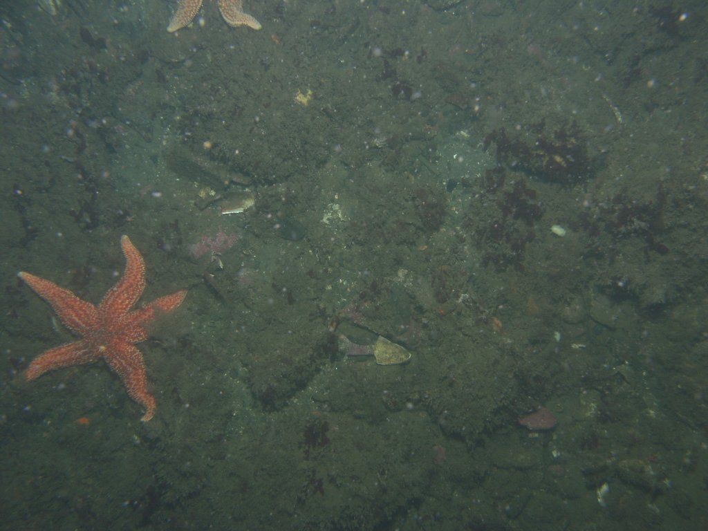
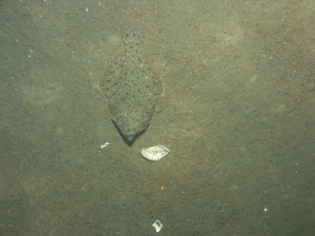
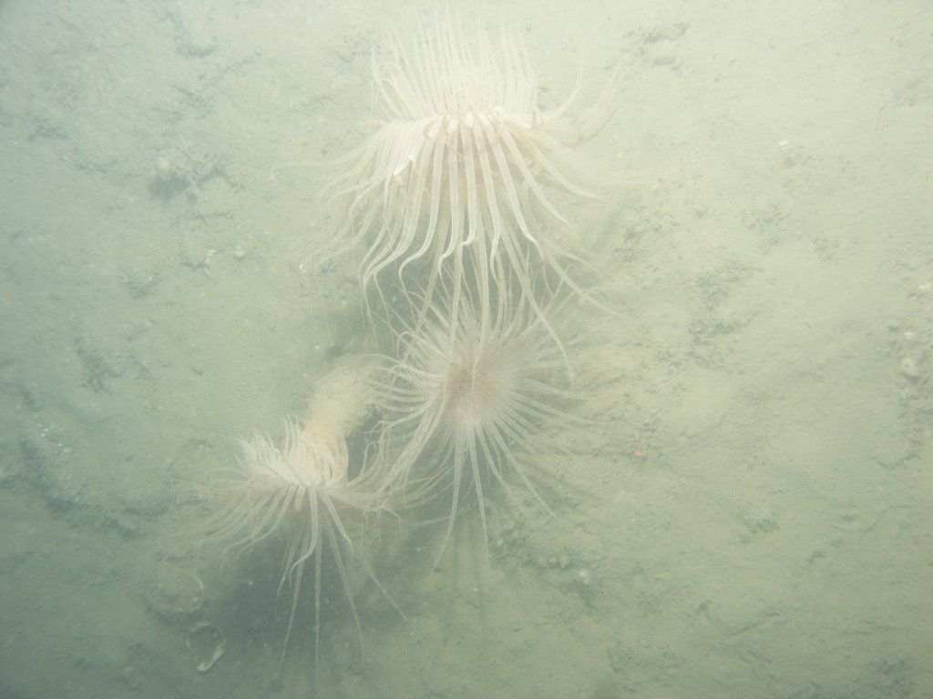
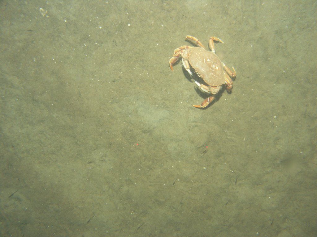
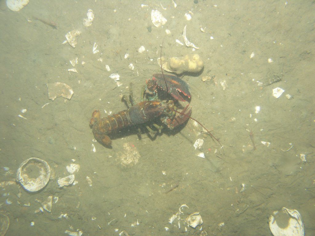
These photos capture a rich diversity of sea life. Lobsters, starfish, sharks, shrimp, skates and crabs all make appearances as well as some well disguised flounder blending in with the sandy bottom.
The report accompanying this data release says that the primary objective of the research is “ to develop geologic information for management of coastal and marine resources.” The report explains that accurate captures of the makeup of the sea floor “are important first steps toward protecting fish habitat, delineating marine reserves, and assessing environmental changes caused by natural or human impacts”.
I really enjoyed looking through this project's photos (looking for sea creatures), as well as those from other bathymetric data collection projects. I always enjoyed exploring the tidal pools of the icy Maine waters as a child, and have always loved any chance to see what lurks below the surface.
We really don't have a good understanding of just how abundant life is on the sea floor, and I am grateful to see that researchers are undertaking such thorough examinations of this other world just off the shore, and that this beautiful imagery is still available for the public to explore.
Full data citation: Barnhardt, W.A., Andrews, B.D., Ackerman, S.D., Baldwin, W.E., and Hein, C.J., 2009, High-resolution geologic mapping of the inner continental shelf; Cape Ann to Salisbury Beach, Massachusetts: U.S. Geological Survey Open-File Report 2007-1373, variously paged, DVD-ROM and available online at https://pubs.usgs.gov/of/2007/1373/.
For this post, I experimented with building a lobster detector using computer vision, but it didn't really work as well as I had hoped, and in the end, the data set was small enough that I could just find the most interesting photos manually.
I built the mosaic of images using ImageMagick, and generated the timelapse of the images using
ffmpeg.I used QGIS to plot out the photograph locations on the overlay of the bathymetry visualization.
You can subscribe to our newsletter to get future posts delivered to your inbox for free. 👉🏻 📫 Subscribe now.
Sharing is caring
📣 If you think your followers or friends may like it, please consider sharing it.
🙋🏻♀️ If you have any suggestions, comments or requests, please email them to beautifulpublicdata@gmail.com
Thanks for reading!
- Jon Keegan (@jonkeegan)