
Aerial Glacier Photographs
A collection of 100,000 striking high-resolution aerial photos of glaciers, photographed over 40 years with a 63-pound WW II surveillance camera.

As scientists study the effects of global warming, one of the most visible and alarming indicators is the rapid shrinking of glaciers. Government scientists have been documenting the size, shape, and movement of glaciers since the 1950s employing techniques ranging from direct field observations to aerial photography.
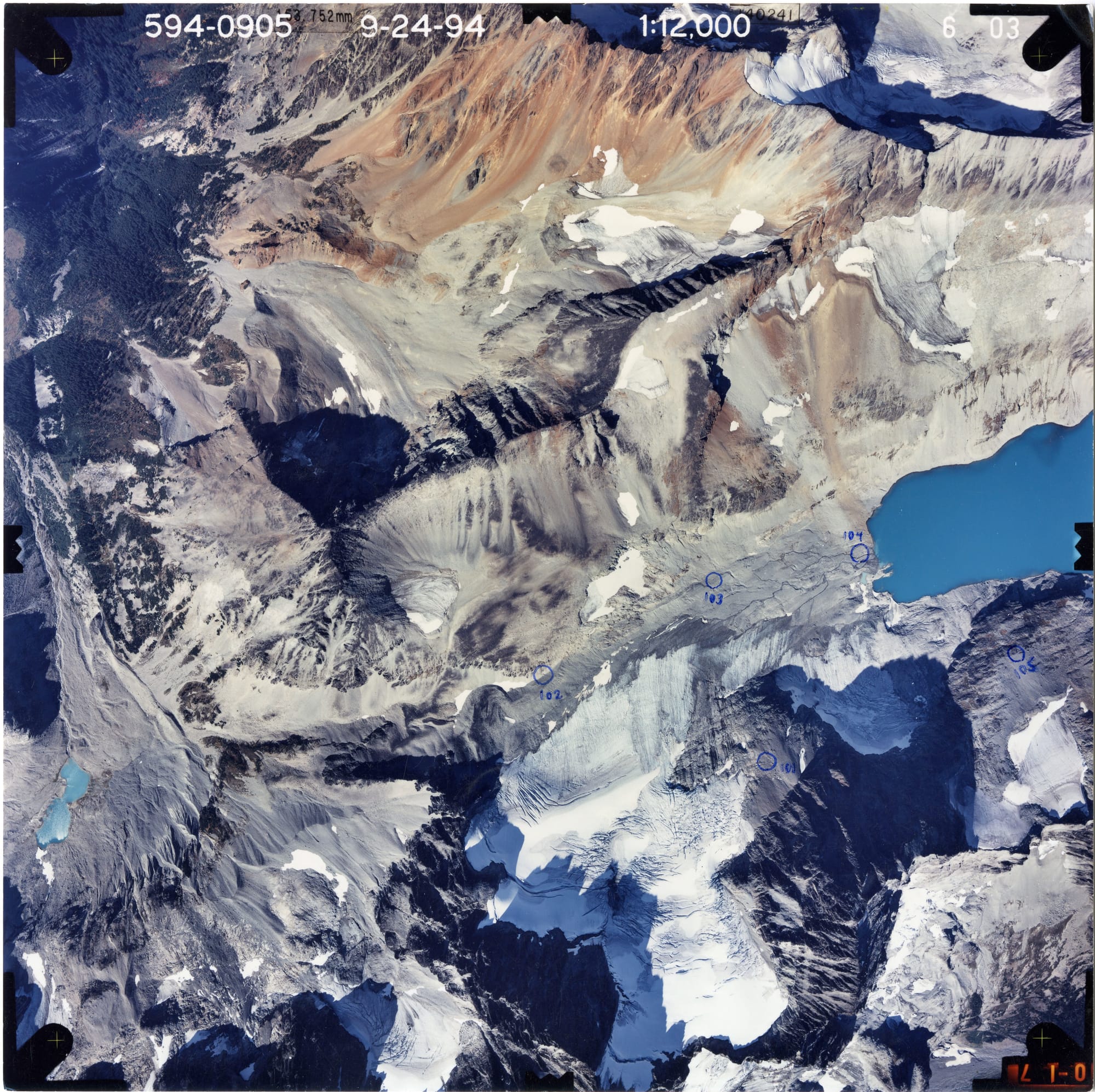
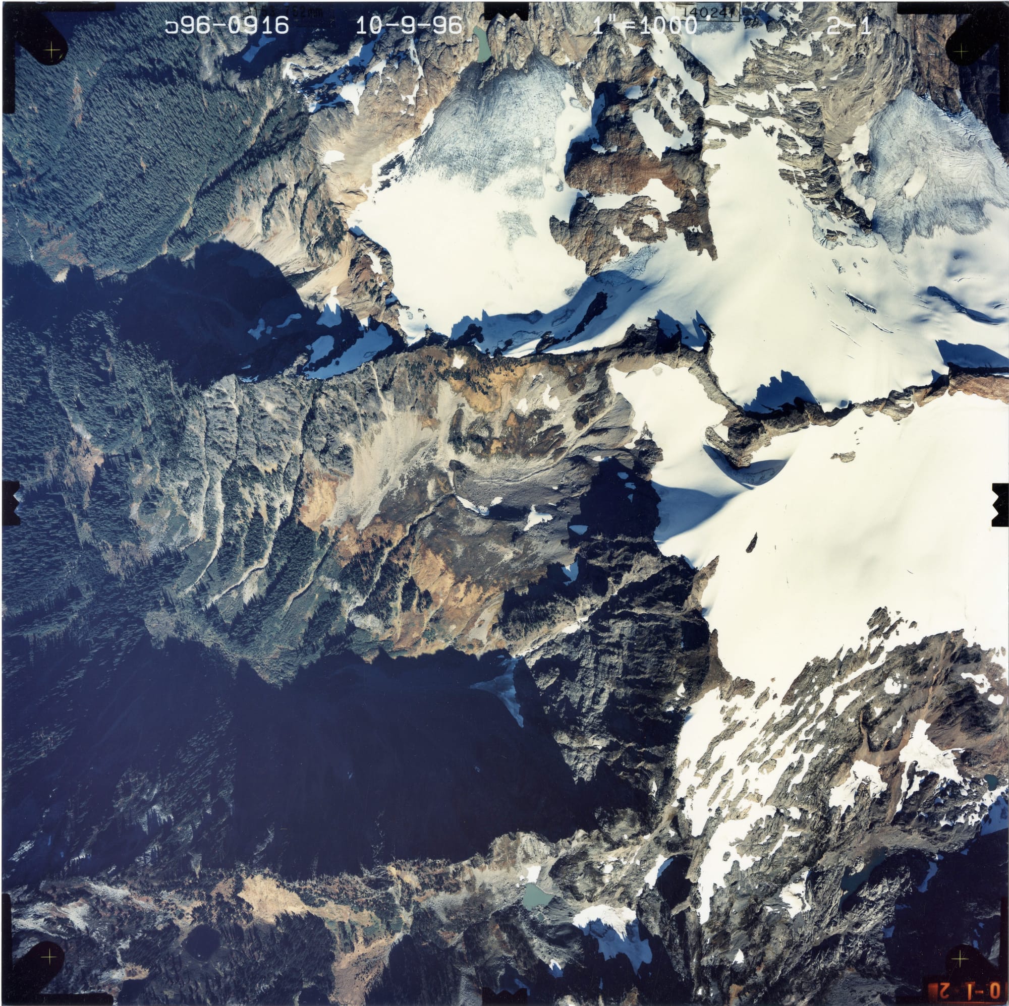
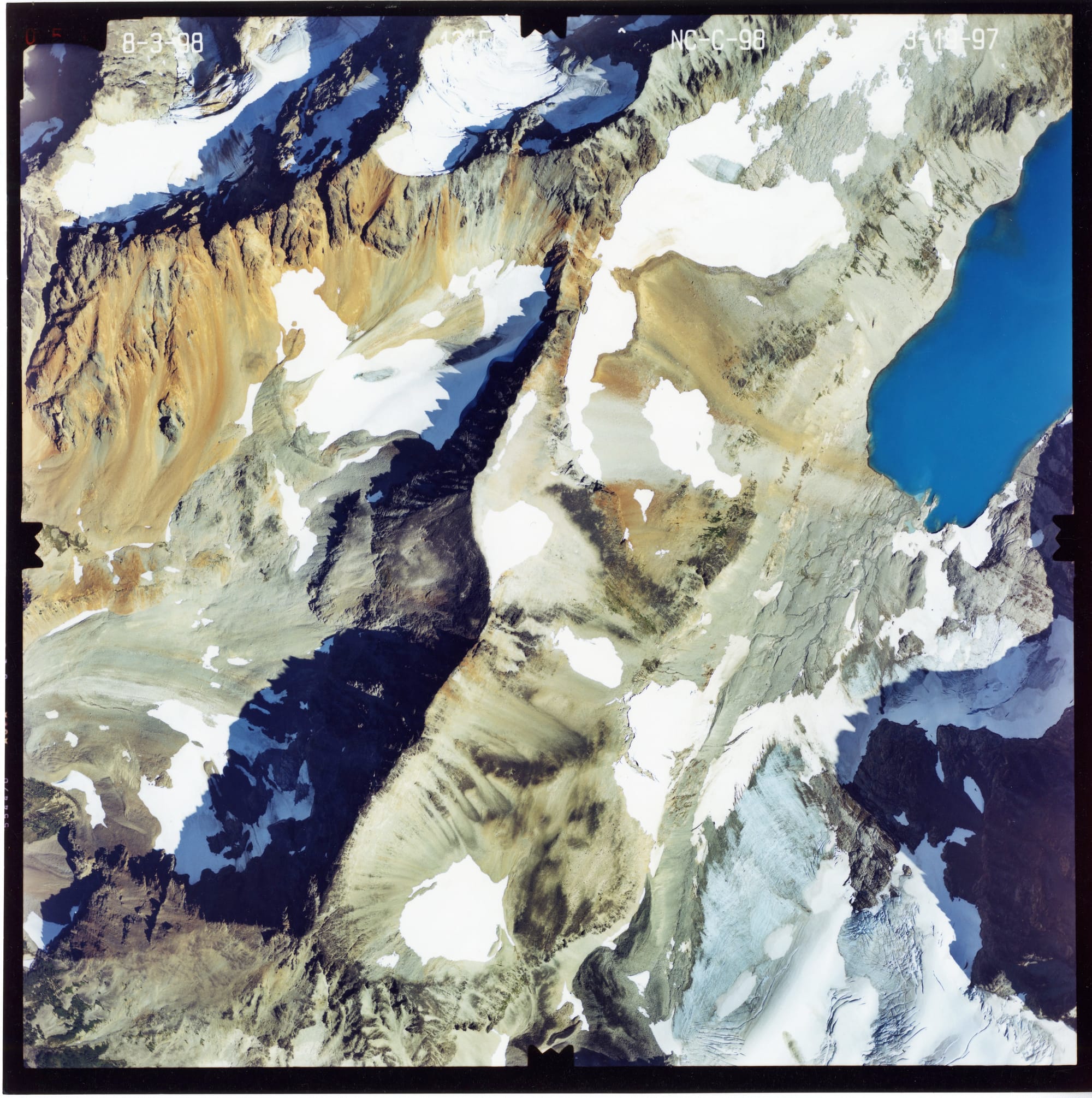
The United States Geological Survey (USGS) has one of the largest collections of aerial glacier photographs. Over 40 years, the USGS’ North American Glacier Aerial Photography (NAGAP) project captured thousands of striking high-resolution photos of glaciers and their surroundings.
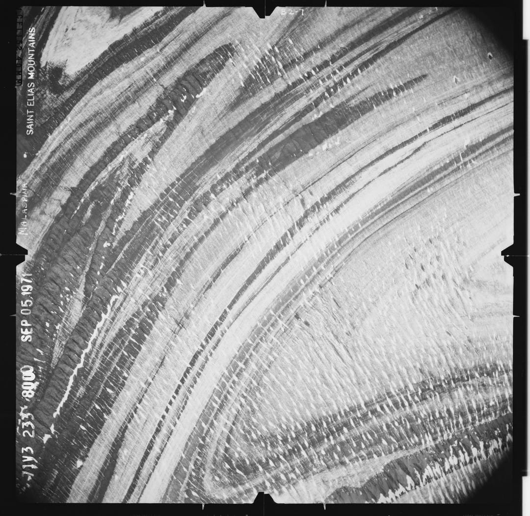
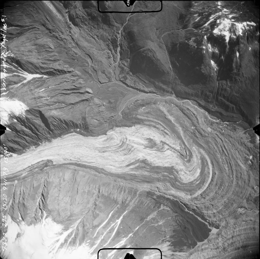
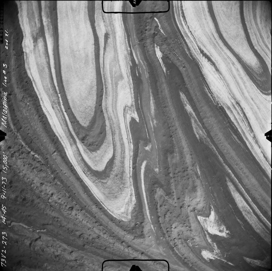
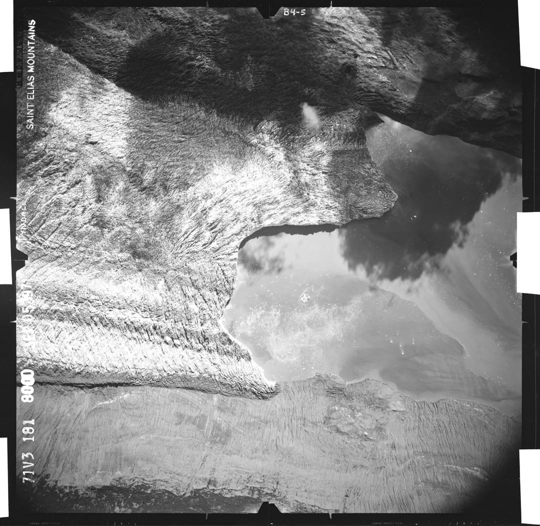
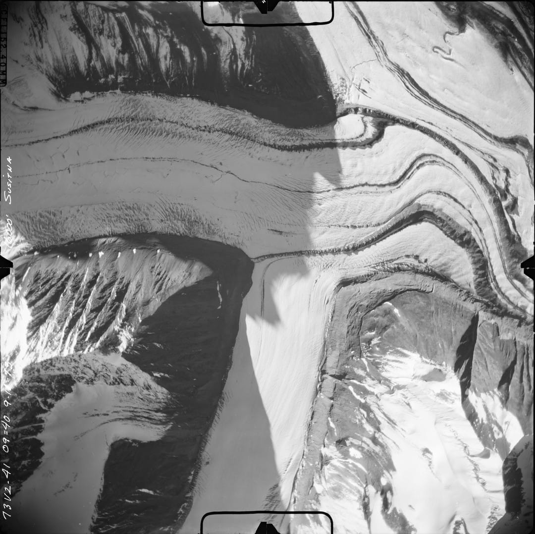
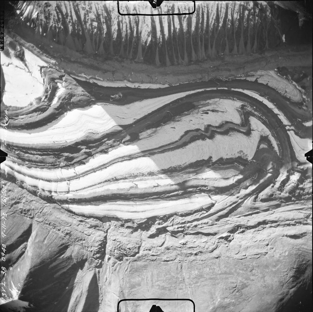
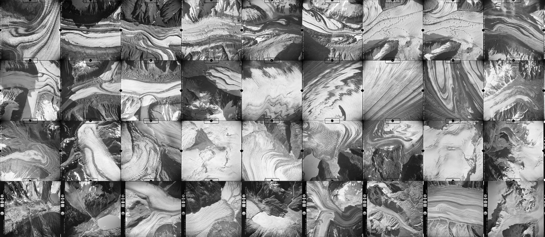
A sample collection of the United States Geological Survey's North American Glacier Aerial Photography (NAGAP) collection. Source: USGS; National Science Foundation Arctic Data Center.
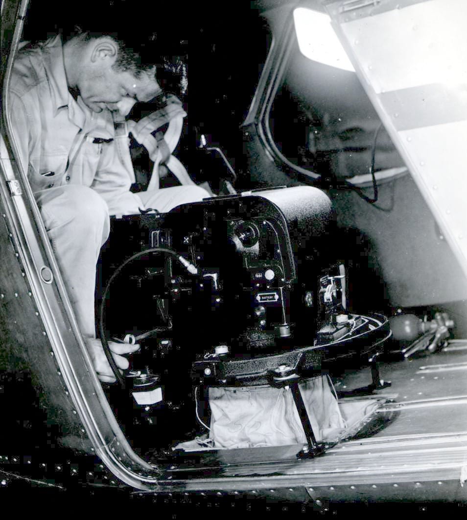
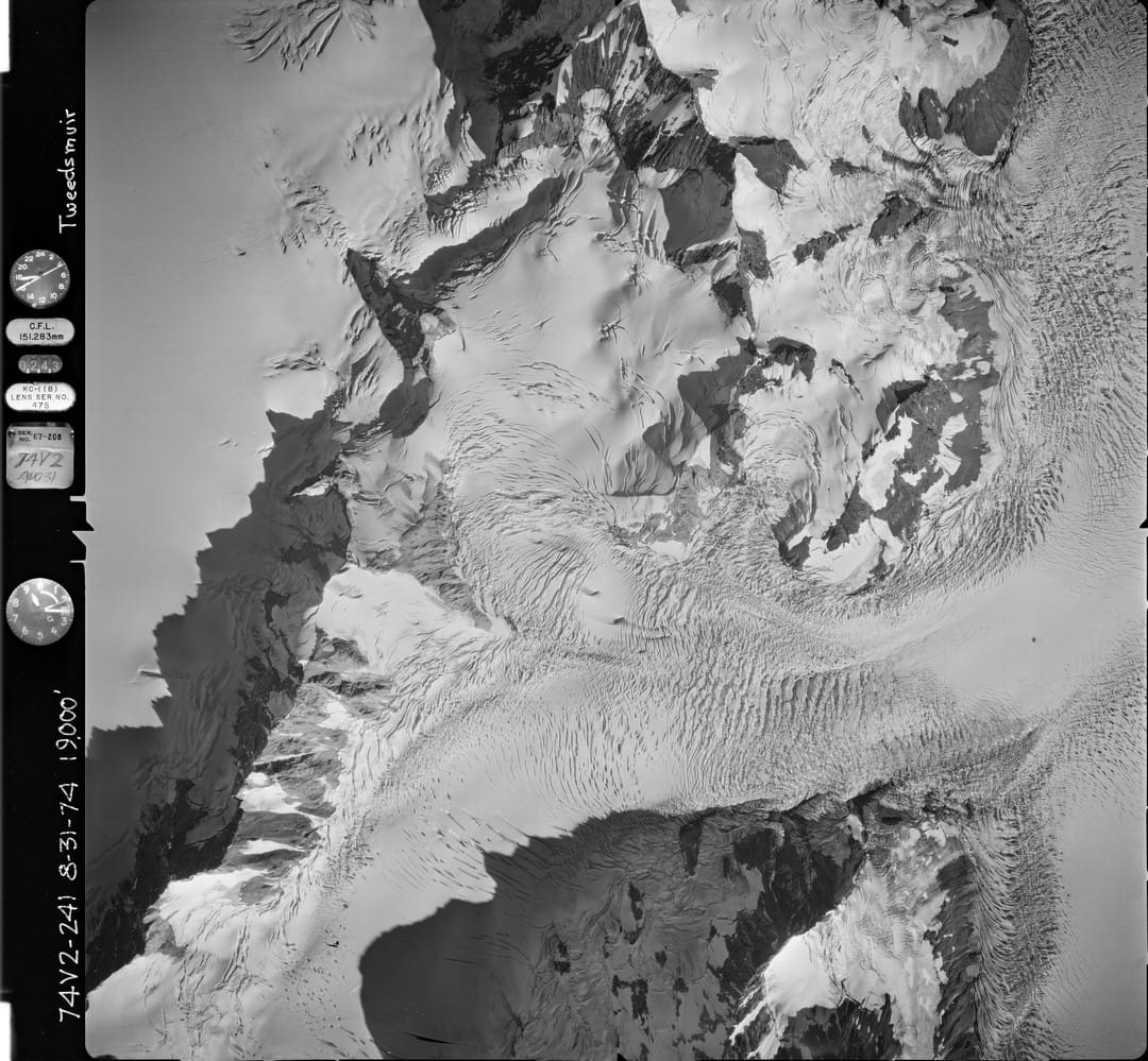
From 1960 to 1983, self-taught glaciologist Austin Post used a 63-pound World War II-era Fairchild K-17 aerial reconnaissance camera to shoot over 100,000 glacier photos in the western US and Alaska. One of the bush pilots Post teamed up with was William R. Fairchild, who flew a Beech 18 twin engine airplane equipped with five K-17 cameras—one mounted on the nose, two in the belly of the plane, and one on each side. The photos were shot in a sequence, with overlapping coverage from 10,000 to 20,000 feet, capturing the images through a 6-inch lens, on 9-by-9-inch panchromatic film, which came in 200 foot rolls.
Post’s extensive collection of photography helped scientists understand the processes of surging and calving, and is considered a “giant of glacier research”. In 2000, “Glacier Ice” was published, a book of Post’s photos with co-author Edward R. LaChapelle.
.jpg?uselang=en&ref=beautifulpublicdata.com#Licensing)
While many of these photos are over sixty years old, they continue to contribute valuable data to glacier science using the latest advances in photogrammetry, the process by which three-dimensional geometry can be generated from analyzing a series of photographs. From 2014 to 2017, researchers scanned around 20,000 of the photos in the NAGAP collection directly from the original negatives.
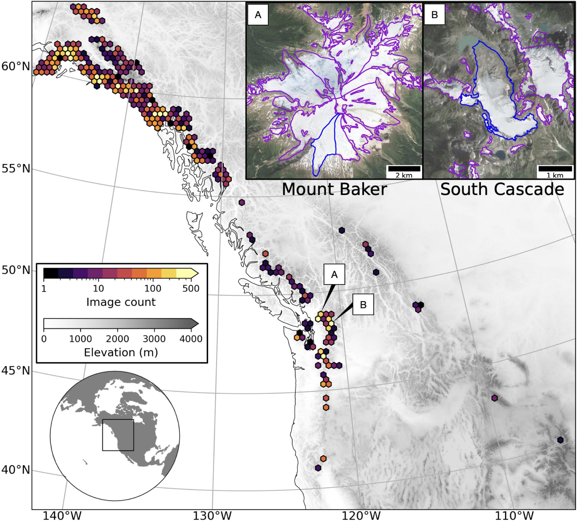
This effort, led by University of Washington researchers, sought to extract this kind of photogrammetric data from the old photographs to observe changes not only in the appearance of the glaciers but also in their actual geometry and volume.
Today the data and photos from the NAGAP collection are hosted at the National Science Foundation's Arctic Data Center.
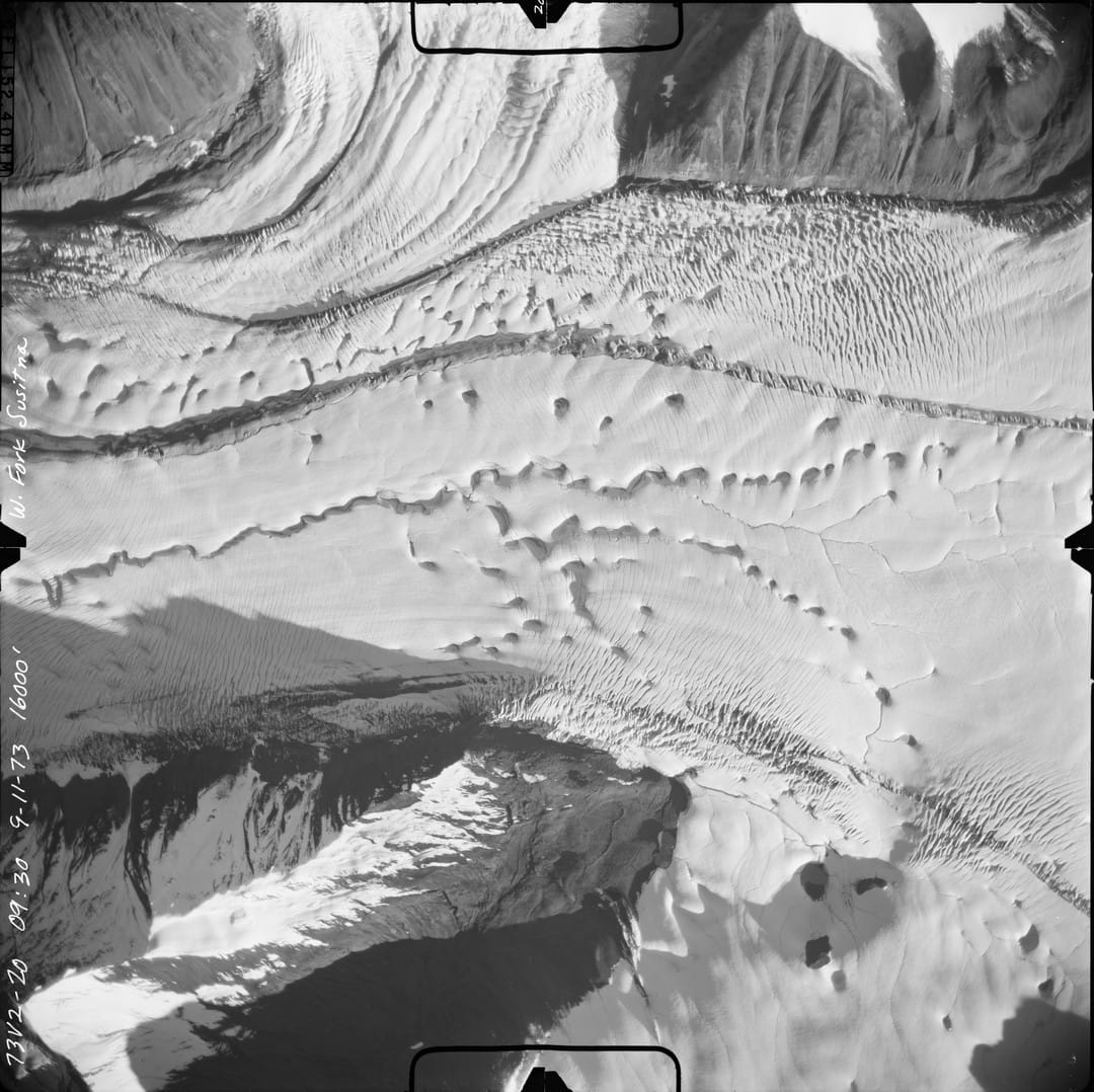
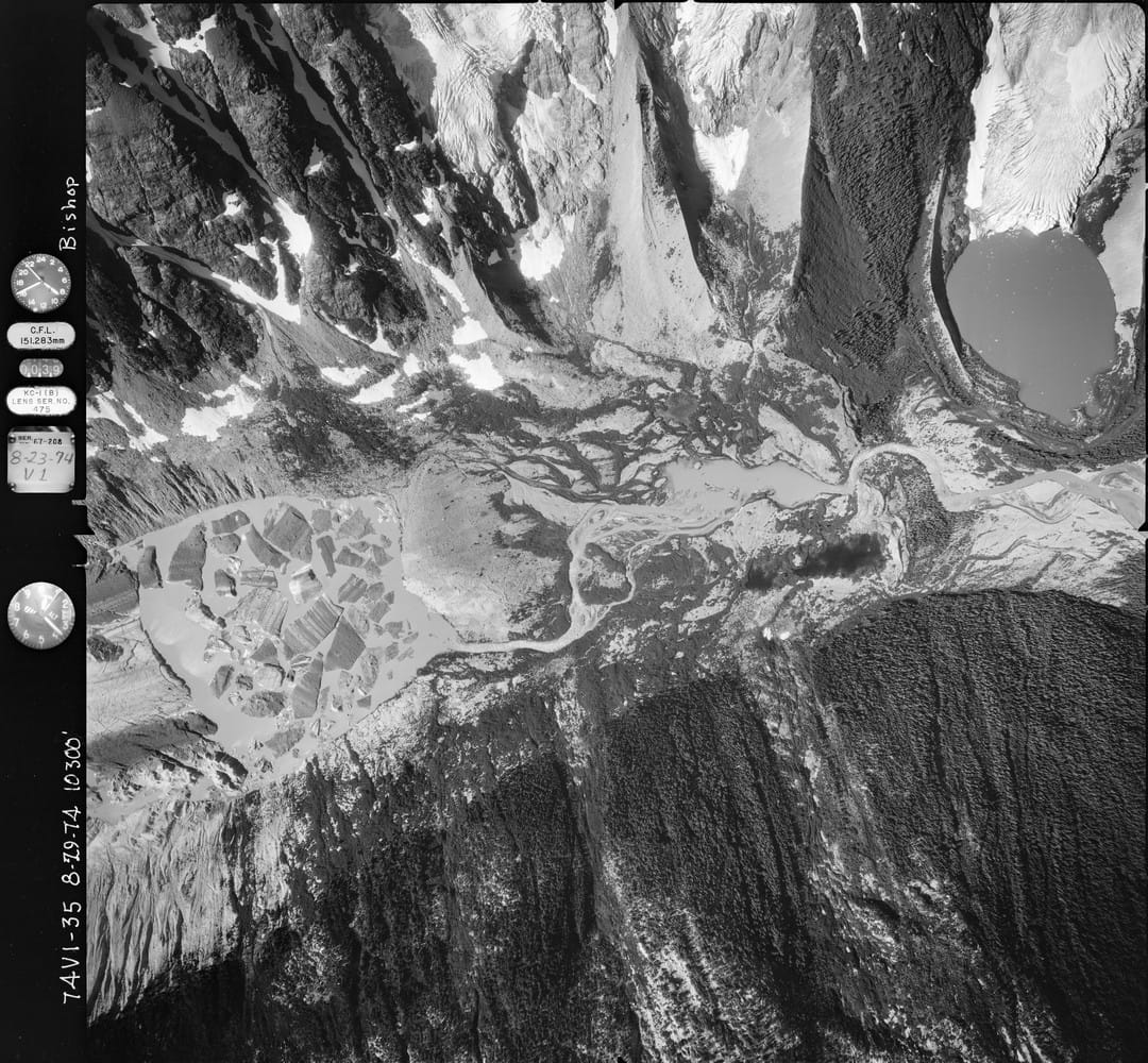
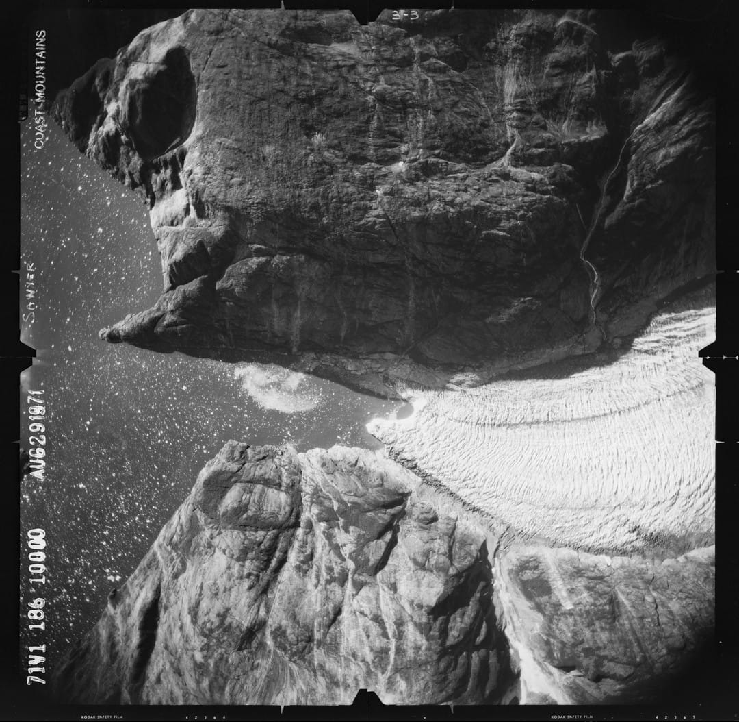
This series of crisp black-and-white images captures an incredible variety of textures with undulating forms that at times become so abstract it is hard to discern what you are looking at, causing a loss of sense of scale. They could be microscopic images of wood grain, feathers, or even images from a probe flying past a moon of Saturn.
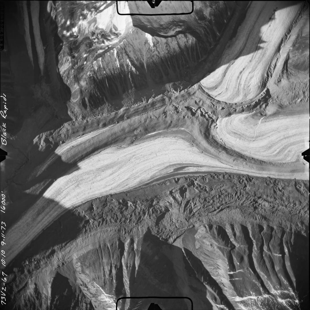
Thankfully, the perimeter of the photos is preserved, containing important data, and details, and evidence of the camera and the photographer’s handwriting noting the subject of the photo, the film roll, and the date. Many photos include an indicator noting the serial number and focal length of the lens (151.283 mm in many photos), and some contain a 24-hour clock face to note the time the photo was taken, and also an altimeter indicating the altitude of the flight. All of this rich metadata was captured with physical instruments, decades before digital photography. These photos are worth viewing in high resolution on a large screen.
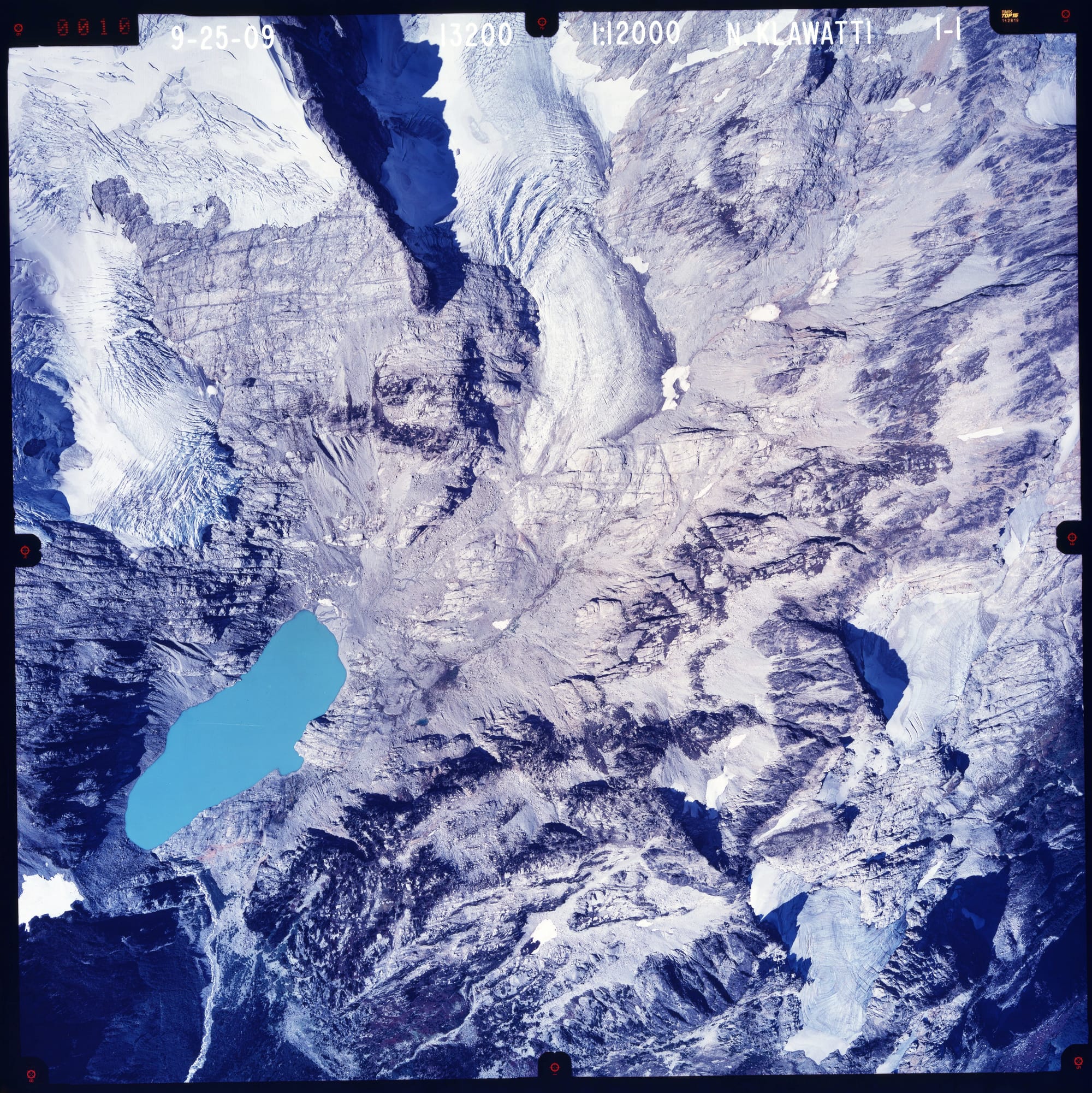
North Cascade Glaciers
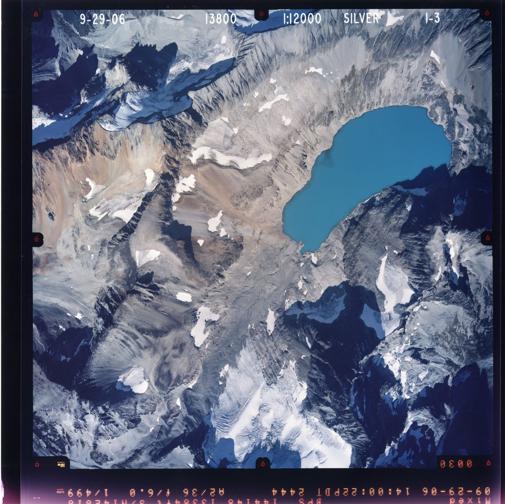
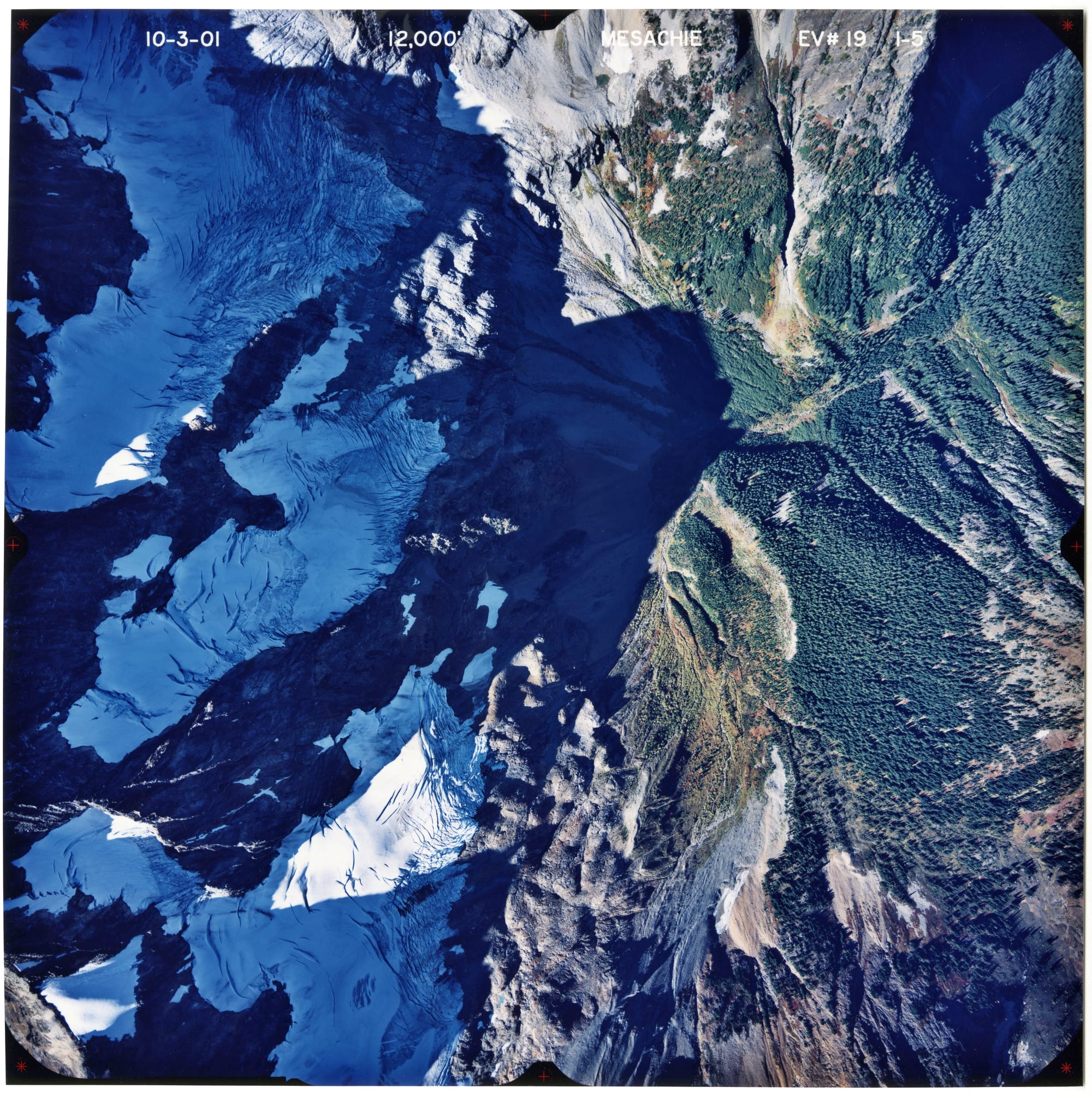
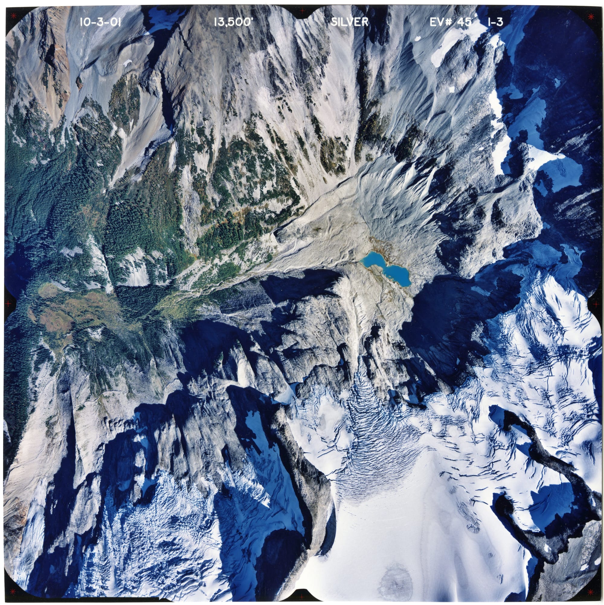
The National Park Service also maintains an archive of incredible color glacier photos. In the US, one of the highest concentrations of mountain glaciers (aside from Alaska) can be found in Washington’s North Cascades National Park (NOCA). This stunning national park has over 300 glaciers—around one-third of all of the glaciers in the lower 48 states.
The dataset primarily focuses on four main glaciers: Noisy Creek, North Klawatti, Sandalee, and Silver Creek glaciers. The collection of 250 photographs spans more than 60 years, with photos from 1947 to 2009.
Samples from the NPS North Cascades National Park aerial glacier photo archive.
Zooming in on these striking high-resolution photos lets you see individual boulders, fissures in the rippling snowpack, and cerulean blue lakes of icy water that look like holes punched out of a desolate rocky landscape.
I put together a CSV with all of the filenames and IDs you need to download this collection here: https://github.com/jonkeegan/nagap-aerial-glacier-photographs
You can subscribe to our newsletter to get future posts delivered to your inbox for free. 👉🏻 📫 Subscribe now.
Sharing is caring
📣 If you think your followers or friends may like it, please consider sharing it.
🙋🏻♀️ If you have any suggestions, comments or requests, please email them to beautifulpublicdata@gmail.com
Thanks for reading!
- Jon Keegan
Threads: @jonkeeganstories
Mastodon: mastodon.social/@jonkeegan

Mirror Fusion Schematic T-Shirts
Featuring a schematic of the 400 ton "yin-yang" magnet used in the The Mirror Fusion Test Facility at Lawrence Livermore National Laboratories. Source: Lawrence Livermore National Laboratories archives.